You are here: Home > Network List > TA - USArray Transportable Network (new EarthScope stations) Stations List
> Station B18K Kokolik River, AK, USA > Earthquake Result Viewer
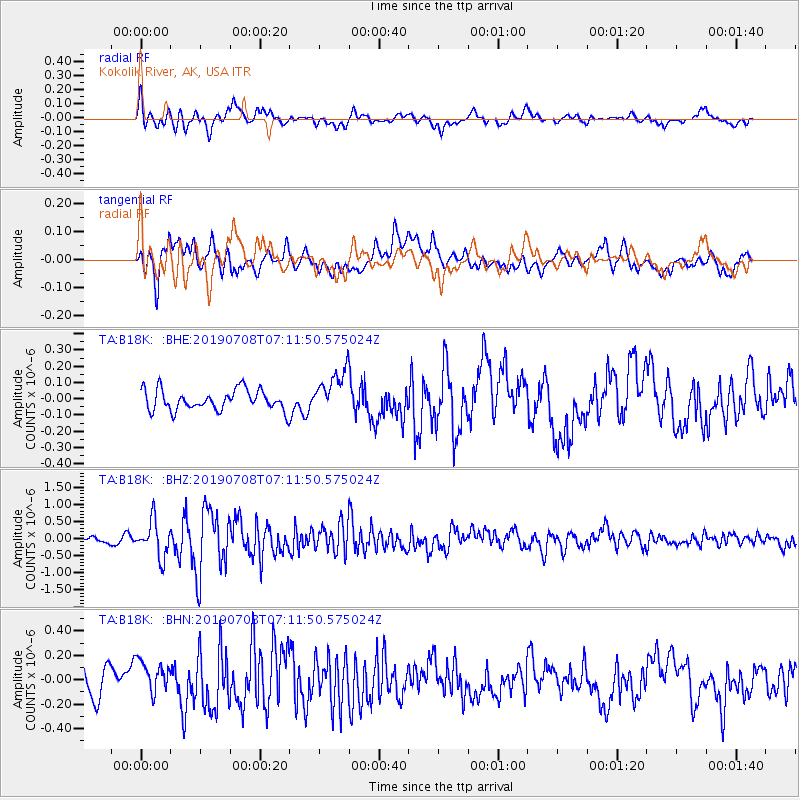
B18K Kokolik River, AK, USA - Earthquake Result Viewer
*The percent match for this event was below the threshold and hence no stack was calculated.
| Earthquake location: |
Western Iran |
| Earthquake latitude/longitude: |
31.8/49.5 |
| Earthquake time(UTC): |
2019/07/08 (189) 07:00:31 GMT |
| Earthquake Depth: |
10 km |
| Earthquake Magnitude: |
5.7 mb |
| Earthquake Catalog/Contributor: |
NEIC PDE/us |
|
| Network: |
TA USArray Transportable Network (new EarthScope stations) |
| Station: |
B18K Kokolik River, AK, USA |
| Lat/Lon: |
69.36 N/161.80 W |
| Elevation: |
222 m |
|
| Distance: |
76.6 deg |
| Az: |
10.928 deg |
| Baz: |
332.905 deg |
| Ray Param: |
$rayparam |
*The percent match for this event was below the threshold and hence was not used in the summary stack. |
|
| Radial Match: |
77.28784 % |
| Radial Bump: |
400 |
| Transverse Match: |
72.60037 % |
| Transverse Bump: |
400 |
| SOD ConfigId: |
19053131 |
| Insert Time: |
2019-07-22 07:05:45.478 +0000 |
| GWidth: |
2.5 |
| Max Bumps: |
400 |
| Tol: |
0.001 |
|
Signal To Noise
| Channel | StoN | STA | LTA |
| TA:B18K: :BHZ:20190708T07:11:50.575024Z | 4.6057563 | 5.1972194E-7 | 1.1284182E-7 |
| TA:B18K: :BHN:20190708T07:11:50.575024Z | 1.3772413 | 1.3344906E-7 | 9.6895924E-8 |
| TA:B18K: :BHE:20190708T07:11:50.575024Z | 2.093548 | 1.3225677E-7 | 6.317351E-8 |
| Arrivals |
| Ps | |
| PpPs | |
| PsPs/PpSs | |


