You are here: Home > Network List > TA - USArray Transportable Network (new EarthScope stations) Stations List
> Station Q04C Lincoln, CA, USA > Earthquake Result Viewer
Q04C Lincoln, CA, USA - Earthquake Result Viewer
| Earthquake location: |
Fiji Islands Region |
| Earthquake latitude/longitude: |
-15.3/-178.6 |
| Earthquake time(UTC): |
2005/12/13 (347) 03:16:06 GMT |
| Earthquake Depth: |
10 km |
| Earthquake Magnitude: |
6.1 MB, 6.8 MS, 6.7 MW, 6.7 MW |
| Earthquake Catalog/Contributor: |
WHDF/NEIC |
|
| Network: |
TA USArray Transportable Network (new EarthScope stations) |
| Station: |
Q04C Lincoln, CA, USA |
| Lat/Lon: |
38.84 N/121.38 W |
| Elevation: |
14 m |
|
| Distance: |
75.8 deg |
| Az: |
42.612 deg |
| Baz: |
236.796 deg |
| Ray Param: |
0.051410902 |
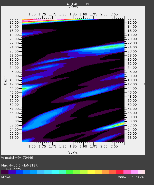
| Estimated Moho Depth: |
10.0 km |
| Estimated Crust Vp/Vs: |
1.77 |
| Assumed Crust Vp: |
6.597 km/s |
| Estimated Crust Vs: |
3.722 km/s |
| Estimated Crust Poisson's Ratio: |
0.27 |
|
| Radial Match: |
94.70449 % |
| Radial Bump: |
376 |
| Transverse Match: |
76.78618 % |
| Transverse Bump: |
400 |
| SOD ConfigId: |
2564 |
| Insert Time: |
2010-03-07 01:23:44.682 +0000 |
| GWidth: |
2.5 |
| Max Bumps: |
400 |
| Tol: |
0.001 |
|
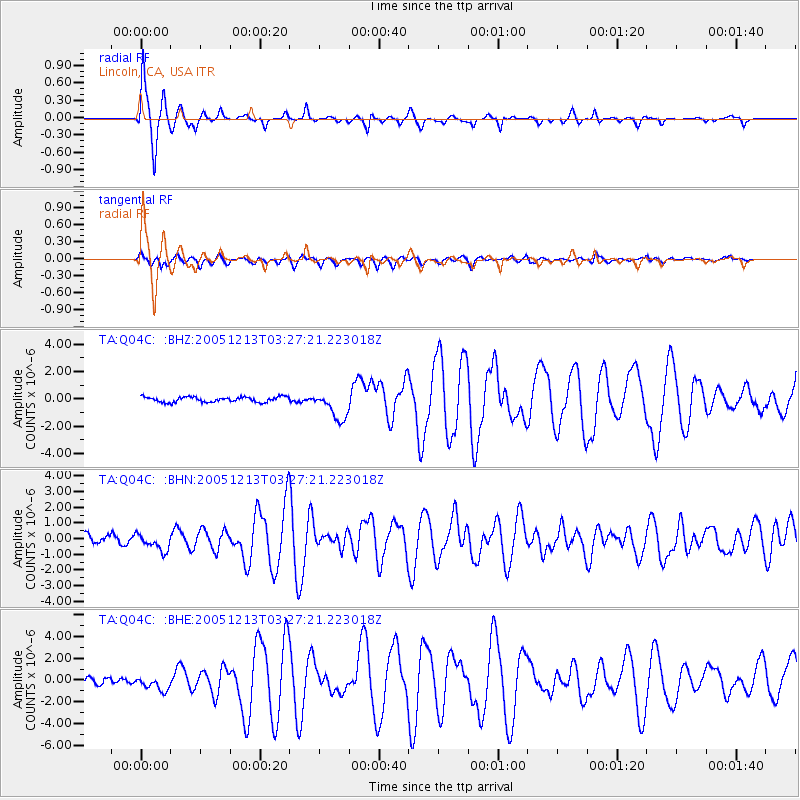
Signal To Noise
| Channel | StoN | STA | LTA |
| TA:Q04C: :BHN:20051213T03:27:21.223018Z | 1.7404372 | 5.289119E-7 | 3.0389603E-7 |
| TA:Q04C: :BHE:20051213T03:27:21.223018Z | 1.7863266 | 6.579043E-7 | 3.683001E-7 |
| TA:Q04C: :BHZ:20051213T03:27:21.223018Z | 5.505547 | 1.0373693E-6 | 1.8842256E-7 |
| Arrivals |
| Ps | 1.2 SECOND |
| PpPs | 4.1 SECOND |
| PsPs/PpSs | 5.3 SECOND |


