Q04C Lincoln, CA, USA - Earthquake Result Viewer
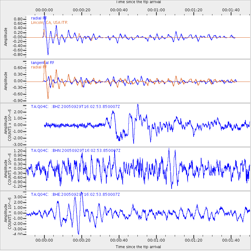
Earthquake location: New Britain Region, P.N.G.
Earthquake latitude/longitude: -5.4/151.8
Earthquake time(UTC): 2005/09/29 (272) 15:50:24 GMT
Earthquake Depth: 25 km
Earthquake Magnitude: 5.9 MB, 6.6 MS, 6.7 MW, 6.5 MW
Earthquake Catalog/Contributor: WHDF/NEIC
Network: TA USArray Transportable Network (new EarthScope stations)
Station: Q04C Lincoln, CA, USA
Lat/Lon: 38.84 N/121.38 W
Elevation: 14 m
Distance: 90.9 deg
Az: 51.244 deg
Baz: 263.776 deg
Ray Param: 0.041640166
Estimated Moho Depth: 10.0 km
Estimated Crust Vp/Vs: 1.60
Assumed Crust Vp: 6.597 km/s
Estimated Crust Vs: 4.123 km/s
Estimated Crust Poisson's Ratio: 0.18
Radial Match: 91.07051 %
Radial Bump: 400
Transverse Match: 69.69625 %
Transverse Bump: 400
SOD ConfigId: 2475
Insert Time: 2010-03-07 01:24:07.746 +0000
GWidth: 2.5
Max Bumps: 400
Tol: 0.001

Signal To Noise

ChannelStoNSTALTA
TA:Q04C: :BHN:20050929T16:02:53.850007Z1.15295483.6389207E-73.1561694E-7
TA:Q04C: :BHE:20050929T16:02:53.850007Z1.74881844.84695E-72.771557E-7
TA:Q04C: :BHZ:20050929T16:02:53.850007Z2.65907964.4733244E-71.682283E-7
Arrivals
Ps0.9 SECOND
PpPs3.8 SECOND
PsPs/PpSs4.8 SECOND