Q04C Lincoln, CA, USA - Earthquake Result Viewer
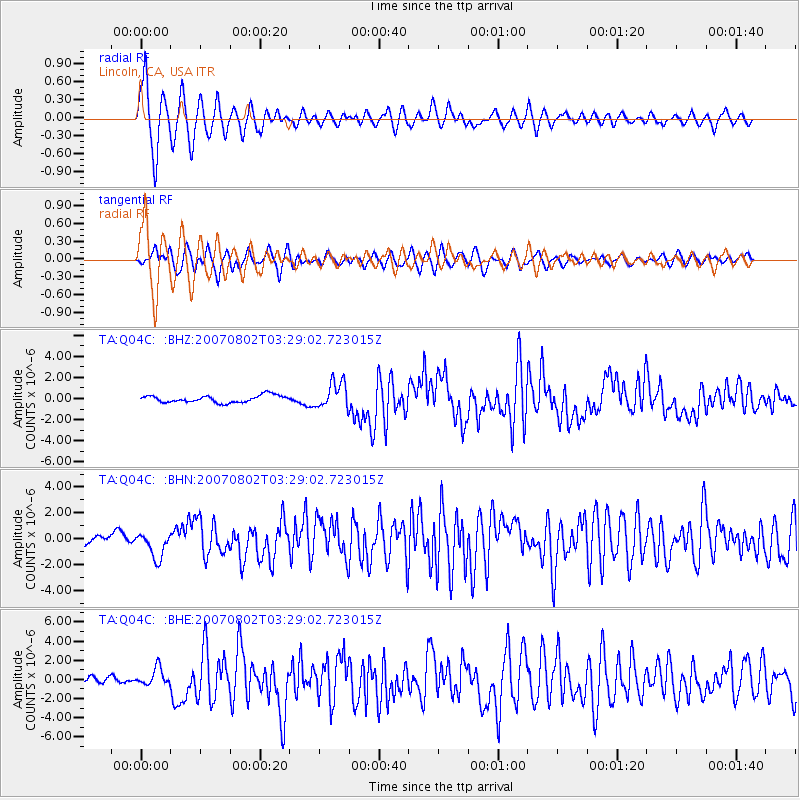
Earthquake location: Andreanof Islands, Aleutian Is.
Earthquake latitude/longitude: 51.3/-180.0
Earthquake time(UTC): 2007/08/02 (214) 03:21:42 GMT
Earthquake Depth: 21 km
Earthquake Magnitude: 6.3 MB, 6.6 MS, 6.7 MW, 6.6 MW
Earthquake Catalog/Contributor: WHDF/NEIC
Network: TA USArray Transportable Network (new EarthScope stations)
Station: Q04C Lincoln, CA, USA
Lat/Lon: 38.84 N/121.38 W
Elevation: 14 m
Distance: 42.1 deg
Az: 83.559 deg
Baz: 306.996 deg
Ray Param: 0.07332591
Estimated Moho Depth: 11.75 km
Estimated Crust Vp/Vs: 1.60
Assumed Crust Vp: 6.597 km/s
Estimated Crust Vs: 4.123 km/s
Estimated Crust Poisson's Ratio: 0.18
Radial Match: 84.42148 %
Radial Bump: 400
Transverse Match: 75.621925 %
Transverse Bump: 400
SOD ConfigId: 2564
Insert Time: 2010-03-07 01:24:26.185 +0000
GWidth: 2.5
Max Bumps: 400
Tol: 0.001

Signal To Noise

ChannelStoNSTALTA
TA:Q04C: :BHN:20070802T03:29:02.723015Z2.48121249.925584E-74.0002956E-7
TA:Q04C: :BHE:20070802T03:29:02.723015Z2.19807589.0654095E-74.1242478E-7
TA:Q04C: :BHZ:20070802T03:29:02.723015Z3.71483971.243472E-63.3473097E-7
Arrivals
Ps1.2 SECOND
PpPs4.3 SECOND
PsPs/PpSs5.4 SECOND