Q04C Lincoln, CA, USA - Earthquake Result Viewer
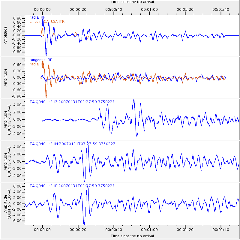
Earthquake location: Kermadec Islands, New Zealand
Earthquake latitude/longitude: -29.8/-178.0
Earthquake time(UTC): 2007/01/31 (031) 03:15:52 GMT
Earthquake Depth: 34 km
Earthquake Magnitude: 6.1 MB, 6.3 MS, 6.5 MW, 6.4 MW
Earthquake Catalog/Contributor: WHDF/NEIC
Network: TA USArray Transportable Network (new EarthScope stations)
Station: Q04C Lincoln, CA, USA
Lat/Lon: 38.84 N/121.38 W
Elevation: 14 m
Distance: 86.3 deg
Az: 40.81 deg
Baz: 226.683 deg
Ray Param: 0.044121426
Estimated Moho Depth: 10.0 km
Estimated Crust Vp/Vs: 1.70
Assumed Crust Vp: 6.597 km/s
Estimated Crust Vs: 3.881 km/s
Estimated Crust Poisson's Ratio: 0.24
Radial Match: 91.16763 %
Radial Bump: 400
Transverse Match: 77.80143 %
Transverse Bump: 400
SOD ConfigId: 2564
Insert Time: 2010-03-07 01:24:39.745 +0000
GWidth: 2.5
Max Bumps: 400
Tol: 0.001

Signal To Noise

ChannelStoNSTALTA
TA:Q04C: :BHN:20070131T03:27:59.375022Z2.93654948.4754504E-72.8861936E-7
TA:Q04C: :BHE:20070131T03:27:59.375022Z2.75993321.1508338E-64.1697882E-7
TA:Q04C: :BHZ:20070131T03:27:59.375022Z9.808481.3149835E-61.3406597E-7
Arrivals
Ps1.1 SECOND
PpPs4.0 SECOND
PsPs/PpSs5.1 SECOND