
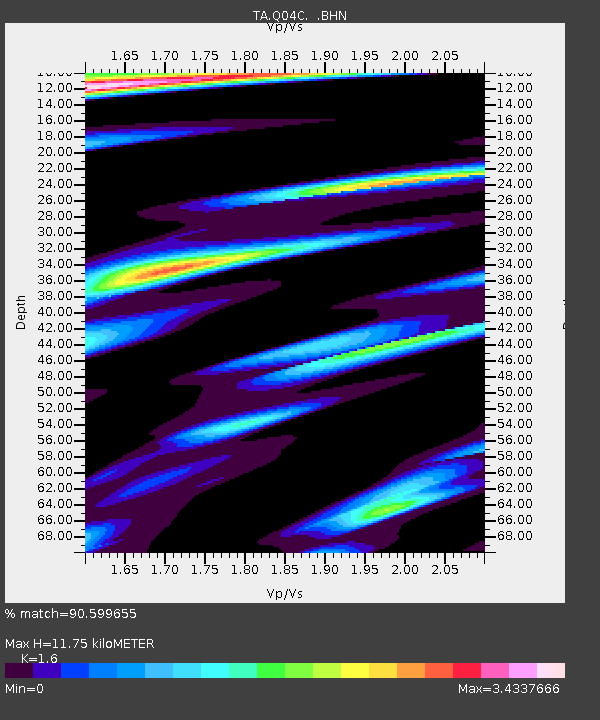
Q04C Lincoln, CA, USA - Earthquake Result Viewer
| ||||||||||||||||||
| ||||||||||||||||||
| ||||||||||||||||||
|
Signal To Noise
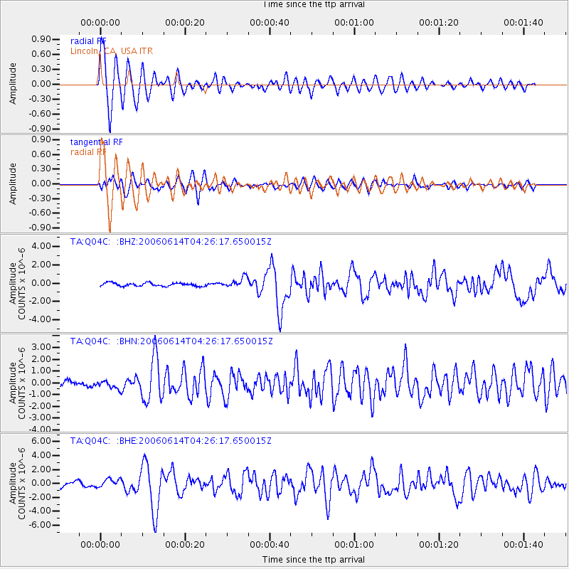
| Channel | StoN | STA | LTA |
| TA:Q04C: :BHN:20060614T04:26:17.650015Z | 1.1101533 | 3.2623623E-7 | 2.9386592E-7 |
| TA:Q04C: :BHE:20060614T04:26:17.650015Z | 1.6010745 | 5.9540673E-7 | 3.7187948E-7 |
| TA:Q04C: :BHZ:20060614T04:26:17.650015Z | 3.2420526 | 5.7313E-7 | 1.7677998E-7 |
| Arrivals | |
| Ps | 1.2 SECOND |
| PpPs | 4.3 SECOND |
| PsPs/PpSs | 5.4 SECOND |

