
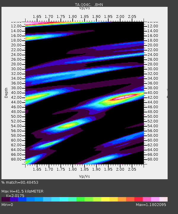
Q04C Lincoln, CA, USA - Earthquake Result Viewer
| ||||||||||||||||||
| ||||||||||||||||||
| ||||||||||||||||||
|
Signal To Noise
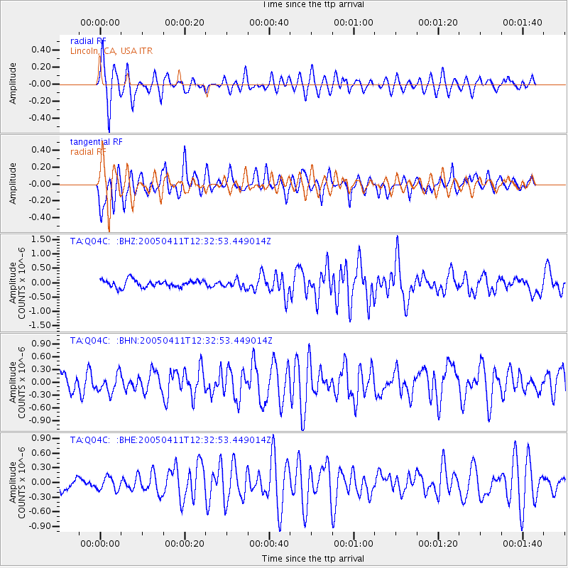
| Channel | StoN | STA | LTA |
| TA:Q04C: :BHN:20050411T12:32:53.449014Z | 1.0553476 | 2.1692298E-7 | 2.0554648E-7 |
| TA:Q04C: :BHE:20050411T12:32:53.449014Z | 0.6978538 | 1.3405946E-7 | 1.9210249E-7 |
| TA:Q04C: :BHZ:20050411T12:32:53.449014Z | 1.1146961 | 1.3936392E-7 | 1.2502413E-7 |
| Arrivals | |
| Ps | 6.5 SECOND |
| PpPs | 19 SECOND |
| PsPs/PpSs | 25 SECOND |

