You are here: Home > Network List > TA - USArray Transportable Network (new EarthScope stations) Stations List
> Station B18K Kokolik River, AK, USA > Earthquake Result Viewer
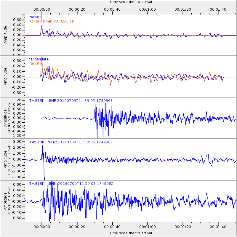
B18K Kokolik River, AK, USA - Earthquake Result Viewer
*The percent match for this event was below the threshold and hence no stack was calculated.
| Earthquake location: |
Sea Of Okhotsk |
| Earthquake latitude/longitude: |
47.4/145.0 |
| Earthquake time(UTC): |
2019/07/09 (190) 11:33:31 GMT |
| Earthquake Depth: |
437 km |
| Earthquake Magnitude: |
5.5 Mww |
| Earthquake Catalog/Contributor: |
NEIC PDE/us |
|
| Network: |
TA USArray Transportable Network (new EarthScope stations) |
| Station: |
B18K Kokolik River, AK, USA |
| Lat/Lon: |
69.36 N/161.80 W |
| Elevation: |
222 m |
|
| Distance: |
33.8 deg |
| Az: |
30.646 deg |
| Baz: |
257.498 deg |
| Ray Param: |
$rayparam |
*The percent match for this event was below the threshold and hence was not used in the summary stack. |
|
| Radial Match: |
78.9513 % |
| Radial Bump: |
400 |
| Transverse Match: |
64.08456 % |
| Transverse Bump: |
400 |
| SOD ConfigId: |
19053131 |
| Insert Time: |
2019-07-23 11:43:13.307 +0000 |
| GWidth: |
2.5 |
| Max Bumps: |
400 |
| Tol: |
0.001 |
|
Signal To Noise
| Channel | StoN | STA | LTA |
| TA:B18K: :BHZ:20190709T11:39:05.174996Z | 13.041606 | 1.1818122E-6 | 9.061861E-8 |
| TA:B18K: :BHN:20190709T11:39:05.174996Z | 5.936666 | 2.8098518E-7 | 4.7330467E-8 |
| TA:B18K: :BHE:20190709T11:39:05.174996Z | 14.955686 | 5.1728665E-7 | 3.458796E-8 |
| Arrivals |
| Ps | |
| PpPs | |
| PsPs/PpSs | |


