M04C Macdoel, CA, USA - Earthquake Result Viewer
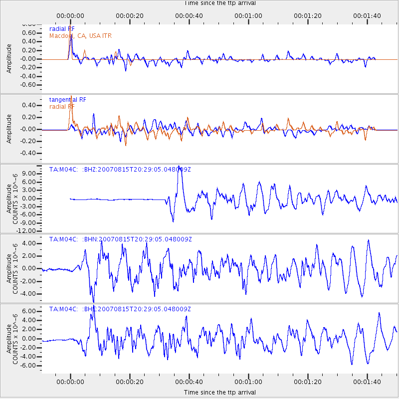
Earthquake location: Andreanof Islands, Aleutian Is.
Earthquake latitude/longitude: 50.3/-177.5
Earthquake time(UTC): 2007/08/15 (227) 20:22:11 GMT
Earthquake Depth: 9.0 km
Earthquake Magnitude: 6.3 MB, 6.2 MS, 6.4 MW, 5.9 ML
Earthquake Catalog/Contributor: WHDF/NEIC
Network: TA USArray Transportable Network (new EarthScope stations)
Station: M04C Macdoel, CA, USA
Lat/Lon: 41.78 N/121.84 W
Elevation: 1391 m
Distance: 38.8 deg
Az: 80.617 deg
Baz: 302.262 deg
Ray Param: 0.07536909
Estimated Moho Depth: 34.25 km
Estimated Crust Vp/Vs: 1.87
Assumed Crust Vp: 6.566 km/s
Estimated Crust Vs: 3.516 km/s
Estimated Crust Poisson's Ratio: 0.30
Radial Match: 85.329216 %
Radial Bump: 400
Transverse Match: 78.44172 %
Transverse Bump: 400
SOD ConfigId: 2564
Insert Time: 2010-03-07 01:29:55.624 +0000
GWidth: 2.5
Max Bumps: 400
Tol: 0.001

Signal To Noise

ChannelStoNSTALTA
TA:M04C: :BHN:20070815T20:29:05.048009Z4.35574157.828661E-71.79732E-7
TA:M04C: :BHE:20070815T20:29:05.048009Z3.71428161.0293022E-62.7712014E-7
TA:M04C: :BHZ:20070815T20:29:05.048009Z25.3044782.9055257E-61.1482259E-7
Arrivals
Ps4.9 SECOND
PpPs14 SECOND
PsPs/PpSs19 SECOND