You are here: Home > Network List > TA - USArray Transportable Network (new EarthScope stations) Stations List
> Station J26L Joseph Creek, AK, USA > Earthquake Result Viewer
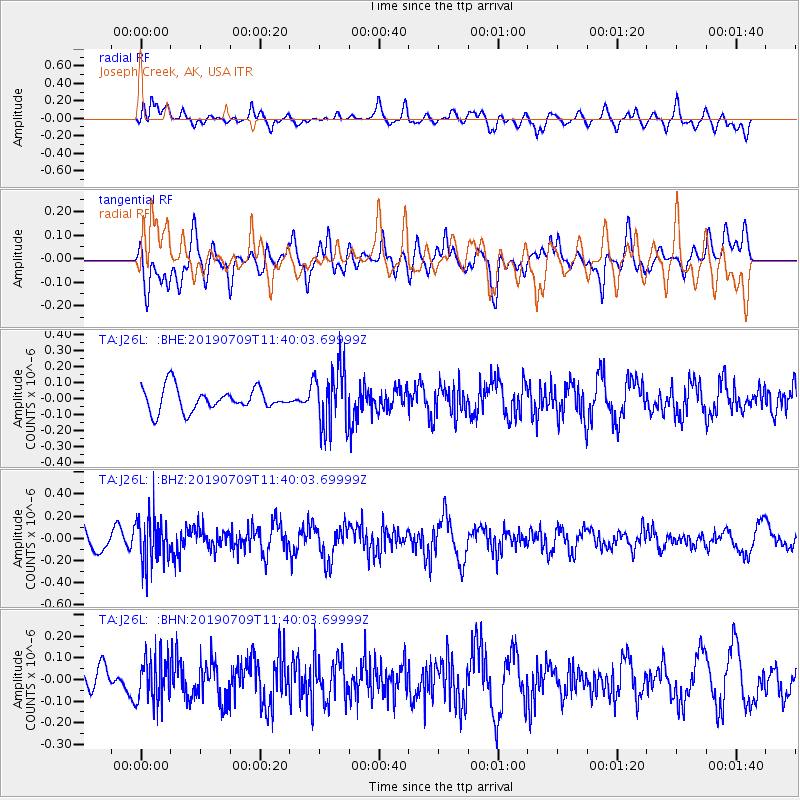
J26L Joseph Creek, AK, USA - Earthquake Result Viewer
*The percent match for this event was below the threshold and hence no stack was calculated.
| Earthquake location: |
Sea Of Okhotsk |
| Earthquake latitude/longitude: |
47.4/145.0 |
| Earthquake time(UTC): |
2019/07/09 (190) 11:33:31 GMT |
| Earthquake Depth: |
437 km |
| Earthquake Magnitude: |
5.5 Mww |
| Earthquake Catalog/Contributor: |
NEIC PDE/us |
|
| Network: |
TA USArray Transportable Network (new EarthScope stations) |
| Station: |
J26L Joseph Creek, AK, USA |
| Lat/Lon: |
64.50 N/143.56 W |
| Elevation: |
1144 m |
|
| Distance: |
40.9 deg |
| Az: |
38.775 deg |
| Baz: |
280.774 deg |
| Ray Param: |
$rayparam |
*The percent match for this event was below the threshold and hence was not used in the summary stack. |
|
| Radial Match: |
53.241753 % |
| Radial Bump: |
400 |
| Transverse Match: |
53.690872 % |
| Transverse Bump: |
400 |
| SOD ConfigId: |
19053131 |
| Insert Time: |
2019-07-23 11:44:05.436 +0000 |
| GWidth: |
2.5 |
| Max Bumps: |
400 |
| Tol: |
0.001 |
|
Signal To Noise
| Channel | StoN | STA | LTA |
| TA:J26L: :BHZ:20190709T11:40:03.69999Z | 2.4035702 | 2.0761297E-7 | 8.637691E-8 |
| TA:J26L: :BHN:20190709T11:40:03.69999Z | 2.3127315 | 1.03336475E-7 | 4.468157E-8 |
| TA:J26L: :BHE:20190709T11:40:03.69999Z | 2.6627824 | 1.9123837E-7 | 7.1818995E-8 |
| Arrivals |
| Ps | |
| PpPs | |
| PsPs/PpSs | |


