M04C Macdoel, CA, USA - Earthquake Result Viewer
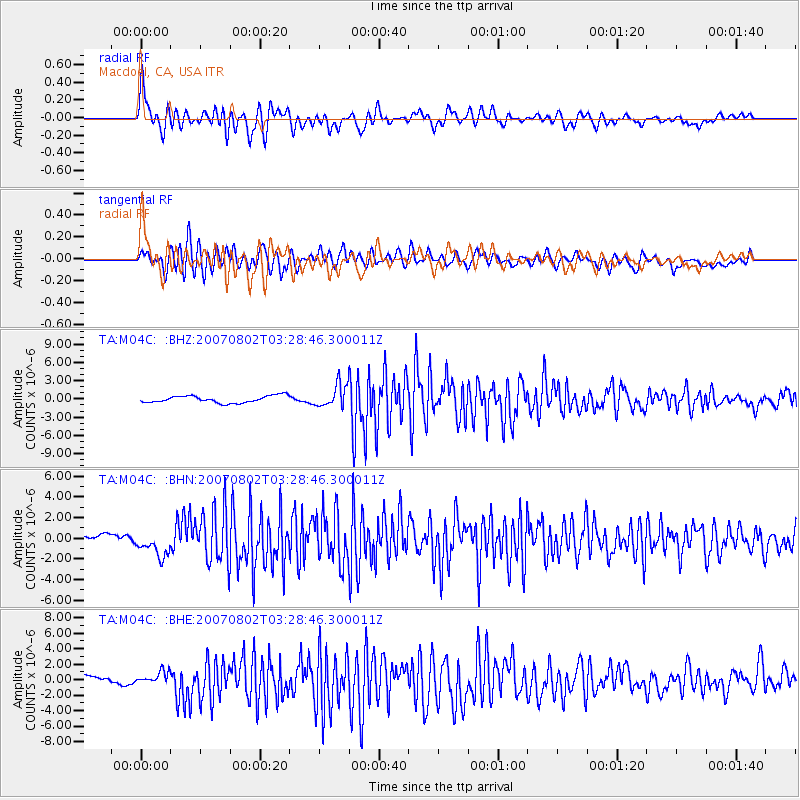
Earthquake location: Andreanof Islands, Aleutian Is.
Earthquake latitude/longitude: 51.3/-180.0
Earthquake time(UTC): 2007/08/02 (214) 03:21:42 GMT
Earthquake Depth: 21 km
Earthquake Magnitude: 6.3 MB, 6.6 MS, 6.7 MW, 6.6 MW
Earthquake Catalog/Contributor: WHDF/NEIC
Network: TA USArray Transportable Network (new EarthScope stations)
Station: M04C Macdoel, CA, USA
Lat/Lon: 41.78 N/121.84 W
Elevation: 1391 m
Distance: 40.1 deg
Az: 80.237 deg
Baz: 304.194 deg
Ray Param: 0.074542776
Estimated Moho Depth: 34.5 km
Estimated Crust Vp/Vs: 1.82
Assumed Crust Vp: 6.566 km/s
Estimated Crust Vs: 3.608 km/s
Estimated Crust Poisson's Ratio: 0.28
Radial Match: 88.06328 %
Radial Bump: 400
Transverse Match: 73.20621 %
Transverse Bump: 400
SOD ConfigId: 2564
Insert Time: 2010-03-07 01:29:57.454 +0000
GWidth: 2.5
Max Bumps: 400
Tol: 0.001

Signal To Noise

ChannelStoNSTALTA
TA:M04C: :BHN:20070802T03:28:46.300011Z3.82741171.1788211E-63.0799433E-7
TA:M04C: :BHE:20070802T03:28:46.300011Z1.42966818.2235084E-75.75204E-7
TA:M04C: :BHZ:20070802T03:28:46.300011Z3.18479161.8349401E-65.7615705E-7
Arrivals
Ps4.6 SECOND
PpPs14 SECOND
PsPs/PpSs18 SECOND