M04C Macdoel, CA, USA - Earthquake Result Viewer
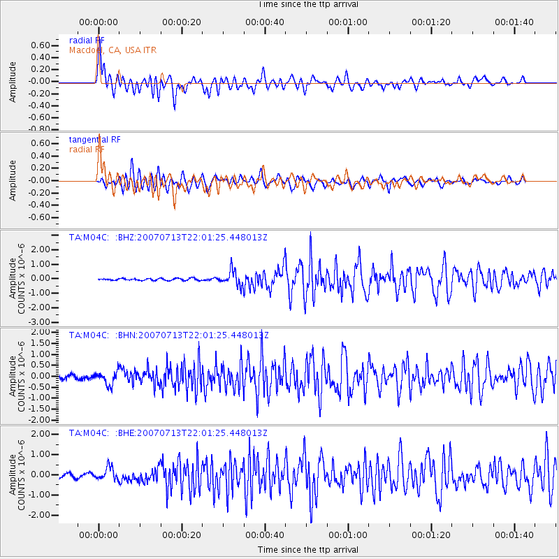
Earthquake location: Andreanof Islands, Aleutian Is.
Earthquake latitude/longitude: 51.8/-176.3
Earthquake time(UTC): 2007/07/13 (194) 21:54:43 GMT
Earthquake Depth: 35 km
Earthquake Magnitude: 5.7 MB, 5.6 MS, 6.0 MW, 5.9 MW
Earthquake Catalog/Contributor: WHDF/NEIC
Network: TA USArray Transportable Network (new EarthScope stations)
Station: M04C Macdoel, CA, USA
Lat/Lon: 41.78 N/121.84 W
Elevation: 1391 m
Distance: 37.8 deg
Az: 83.365 deg
Baz: 304.509 deg
Ray Param: 0.07587668
Estimated Moho Depth: 34.75 km
Estimated Crust Vp/Vs: 1.81
Assumed Crust Vp: 6.566 km/s
Estimated Crust Vs: 3.633 km/s
Estimated Crust Poisson's Ratio: 0.28
Radial Match: 88.10047 %
Radial Bump: 400
Transverse Match: 78.49107 %
Transverse Bump: 400
SOD ConfigId: 2564
Insert Time: 2010-03-07 01:30:14.188 +0000
GWidth: 2.5
Max Bumps: 400
Tol: 0.001

Signal To Noise

ChannelStoNSTALTA
TA:M04C: :BHN:20070713T22:01:25.448013Z2.72203763.0287606E-71.1126814E-7
TA:M04C: :BHE:20070713T22:01:25.448013Z2.36469153.1900336E-71.3490275E-7
TA:M04C: :BHZ:20070713T22:01:25.448013Z7.9006575.305441E-76.71519E-8
Arrivals
Ps4.6 SECOND
PpPs14 SECOND
PsPs/PpSs18 SECOND