You are here: Home > Network List > US - United States National Seismic Network Stations List
> Station AMTX Amarillo, Texas, USA > Earthquake Result Viewer
AMTX Amarillo, Texas, USA - Earthquake Result Viewer
*The percent match for this event was below the threshold and hence no stack was calculated.
| Earthquake location: |
Sea Of Okhotsk |
| Earthquake latitude/longitude: |
47.4/145.0 |
| Earthquake time(UTC): |
2019/07/09 (190) 11:33:31 GMT |
| Earthquake Depth: |
437 km |
| Earthquake Magnitude: |
5.5 Mww |
| Earthquake Catalog/Contributor: |
NEIC PDE/us |
|
| Network: |
US United States National Seismic Network |
| Station: |
AMTX Amarillo, Texas, USA |
| Lat/Lon: |
34.53 N/101.41 W |
| Elevation: |
1010 m |
|
| Distance: |
79.0 deg |
| Az: |
50.44 deg |
| Baz: |
320.651 deg |
| Ray Param: |
$rayparam |
*The percent match for this event was below the threshold and hence was not used in the summary stack. |
|
| Radial Match: |
57.293232 % |
| Radial Bump: |
400 |
| Transverse Match: |
55.245243 % |
| Transverse Bump: |
400 |
| SOD ConfigId: |
19053131 |
| Insert Time: |
2019-07-23 11:45:48.689 +0000 |
| GWidth: |
2.5 |
| Max Bumps: |
400 |
| Tol: |
0.001 |
|
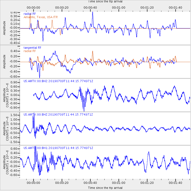
Signal To Noise
| Channel | StoN | STA | LTA |
| US:AMTX:00:BHZ:20190709T11:44:15.774971Z | 3.169954 | 5.595701E-7 | 1.765231E-7 |
| US:AMTX:00:BH1:20190709T11:44:15.774971Z | 2.451596 | 3.5953764E-7 | 1.4665453E-7 |
| US:AMTX:00:BH2:20190709T11:44:15.774971Z | 2.3928373 | 4.3547823E-7 | 1.819924E-7 |
| Arrivals |
| Ps | |
| PpPs | |
| PsPs/PpSs | |


