You are here: Home > Network List > US - United States National Seismic Network Stations List
> Station HLID Hailey, Idaho, USA > Earthquake Result Viewer
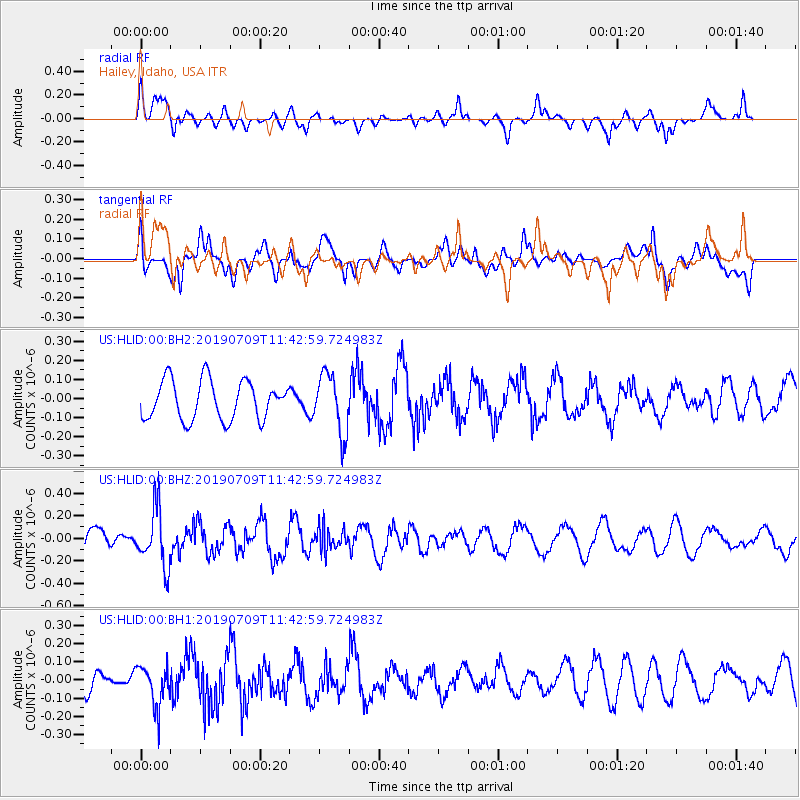
HLID Hailey, Idaho, USA - Earthquake Result Viewer
*The percent match for this event was below the threshold and hence no stack was calculated.
| Earthquake location: |
Sea Of Okhotsk |
| Earthquake latitude/longitude: |
47.4/145.0 |
| Earthquake time(UTC): |
2019/07/09 (190) 11:33:31 GMT |
| Earthquake Depth: |
437 km |
| Earthquake Magnitude: |
5.5 Mww |
| Earthquake Catalog/Contributor: |
NEIC PDE/us |
|
| Network: |
US United States National Seismic Network |
| Station: |
HLID Hailey, Idaho, USA |
| Lat/Lon: |
43.56 N/114.41 W |
| Elevation: |
1772 m |
|
| Distance: |
65.6 deg |
| Az: |
51.726 deg |
| Baz: |
312.839 deg |
| Ray Param: |
$rayparam |
*The percent match for this event was below the threshold and hence was not used in the summary stack. |
|
| Radial Match: |
49.5502 % |
| Radial Bump: |
387 |
| Transverse Match: |
39.375027 % |
| Transverse Bump: |
400 |
| SOD ConfigId: |
19053131 |
| Insert Time: |
2019-07-23 11:45:56.828 +0000 |
| GWidth: |
2.5 |
| Max Bumps: |
400 |
| Tol: |
0.001 |
|
Signal To Noise
| Channel | StoN | STA | LTA |
| US:HLID:00:BHZ:20190709T11:42:59.724983Z | 2.519483 | 2.5807185E-7 | 1.02430484E-7 |
| US:HLID:00:BH1:20190709T11:42:59.724983Z | 1.6098464 | 1.11836165E-7 | 6.947009E-8 |
| US:HLID:00:BH2:20190709T11:42:59.724983Z | 1.5309103 | 1.5579025E-7 | 1.0176315E-7 |
| Arrivals |
| Ps | |
| PpPs | |
| PsPs/PpSs | |


