You are here: Home > Network List > UW - Pacific Northwest Regional Seismic Network Stations List
> Station HOOD Mt Hood Meadows, OR CREST BB SMO > Earthquake Result Viewer
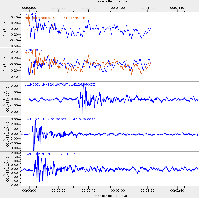
HOOD Mt Hood Meadows, OR CREST BB SMO - Earthquake Result Viewer
*The percent match for this event was below the threshold and hence no stack was calculated.
| Earthquake location: |
Sea Of Okhotsk |
| Earthquake latitude/longitude: |
47.4/145.0 |
| Earthquake time(UTC): |
2019/07/09 (190) 11:33:31 GMT |
| Earthquake Depth: |
437 km |
| Earthquake Magnitude: |
5.5 Mww |
| Earthquake Catalog/Contributor: |
NEIC PDE/us |
|
| Network: |
UW Pacific Northwest Regional Seismic Network |
| Station: |
HOOD Mt Hood Meadows, OR CREST BB SMO |
| Lat/Lon: |
45.32 N/121.65 W |
| Elevation: |
1520 m |
|
| Distance: |
60.5 deg |
| Az: |
54.039 deg |
| Baz: |
308.833 deg |
| Ray Param: |
$rayparam |
*The percent match for this event was below the threshold and hence was not used in the summary stack. |
|
| Radial Match: |
62.0992 % |
| Radial Bump: |
400 |
| Transverse Match: |
57.611908 % |
| Transverse Bump: |
400 |
| SOD ConfigId: |
19053131 |
| Insert Time: |
2019-07-23 11:46:31.533 +0000 |
| GWidth: |
2.5 |
| Max Bumps: |
400 |
| Tol: |
0.001 |
|
Signal To Noise
| Channel | StoN | STA | LTA |
| UW:HOOD: :HHZ:20190709T11:42:26.96003Z | 9.078326 | 1.3243219E-6 | 1.4587732E-7 |
| UW:HOOD: :HHN:20190709T11:42:26.96003Z | 2.6833682 | 3.9983436E-7 | 1.4900466E-7 |
| UW:HOOD: :HHE:20190709T11:42:26.96003Z | 2.0315554 | 3.4488997E-7 | 1.6976645E-7 |
| Arrivals |
| Ps | |
| PpPs | |
| PsPs/PpSs | |


