You are here: Home > Network List > GS - US Geological Survey Networks Stations List
> Station KAN08 Pence Farm, Harper, KS, USA > Earthquake Result Viewer
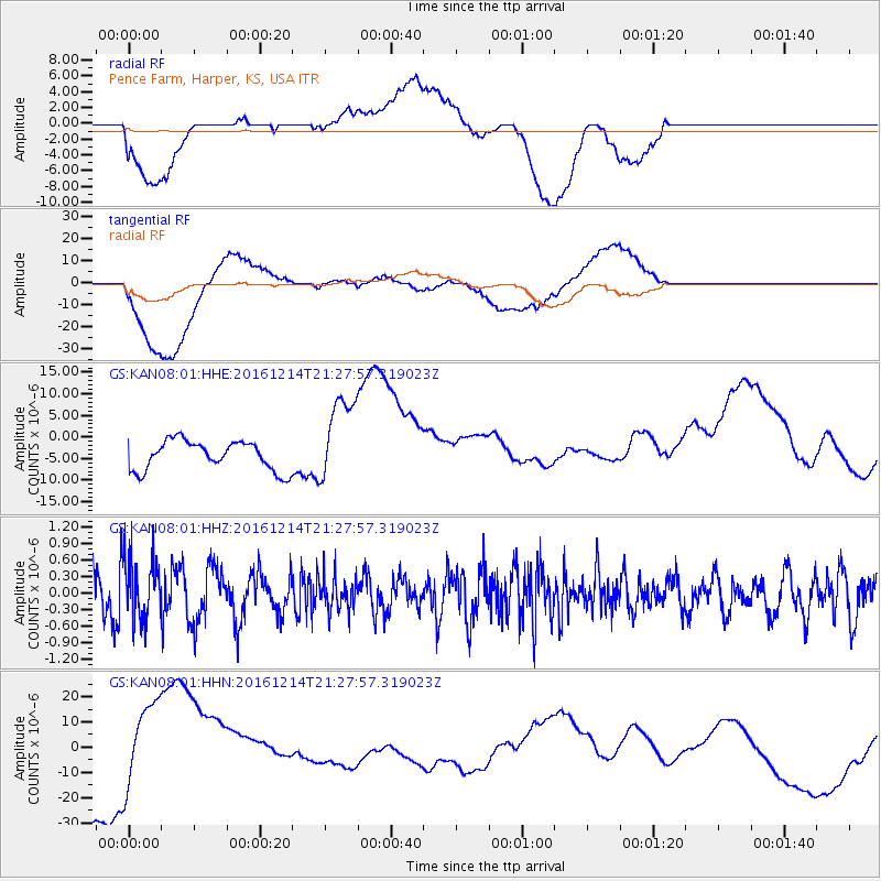
KAN08 Pence Farm, Harper, KS, USA - Earthquake Result Viewer
*The percent match for this event was below the threshold and hence no stack was calculated.
| Earthquake location: |
Mariana Islands Region |
| Earthquake latitude/longitude: |
21.4/144.3 |
| Earthquake time(UTC): |
2016/12/14 (349) 21:14:58 GMT |
| Earthquake Depth: |
31 km |
| Earthquake Magnitude: |
5.5 mb |
| Earthquake Catalog/Contributor: |
NEIC PDE/us |
|
| Network: |
GS US Geological Survey Networks |
| Station: |
KAN08 Pence Farm, Harper, KS, USA |
| Lat/Lon: |
37.23 N/97.97 W |
| Elevation: |
375 m |
|
| Distance: |
97.3 deg |
| Az: |
45.44 deg |
| Baz: |
303.698 deg |
| Ray Param: |
$rayparam |
*The percent match for this event was below the threshold and hence was not used in the summary stack. |
|
| Radial Match: |
49.34732 % |
| Radial Bump: |
400 |
| Transverse Match: |
61.867027 % |
| Transverse Bump: |
400 |
| SOD ConfigId: |
1894071 |
| Insert Time: |
2016-12-28 21:15:56.131 +0000 |
| GWidth: |
2.5 |
| Max Bumps: |
400 |
| Tol: |
0.001 |
|
Signal To Noise
| Channel | StoN | STA | LTA |
| GS:KAN08:01:HHZ:20161214T21:27:57.319023Z | 1.7046797 | 5.791531E-7 | 3.3974305E-7 |
| GS:KAN08:01:HHN:20161214T21:27:57.319023Z | 1.0737033 | 1.6593438E-5 | 1.5454398E-5 |
| GS:KAN08:01:HHE:20161214T21:27:57.319023Z | 3.0085847 | 1.0165737E-5 | 3.3789097E-6 |
| Arrivals |
| Ps | |
| PpPs | |
| PsPs/PpSs | |


