You are here: Home > Network List > TA - USArray Transportable Network (new EarthScope stations) Stations List
> Station B18K Kokolik River, AK, USA > Earthquake Result Viewer
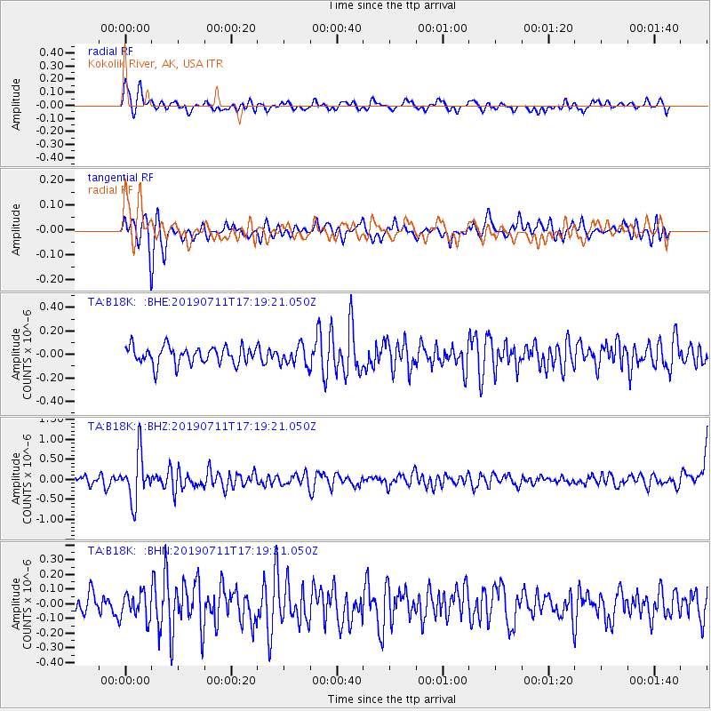
B18K Kokolik River, AK, USA - Earthquake Result Viewer
*The percent match for this event was below the threshold and hence no stack was calculated.
| Earthquake location: |
Solomon Islands |
| Earthquake latitude/longitude: |
-4.7/155.2 |
| Earthquake time(UTC): |
2019/07/11 (192) 17:08:37 GMT |
| Earthquake Depth: |
496 km |
| Earthquake Magnitude: |
6.0 Mww |
| Earthquake Catalog/Contributor: |
NEIC PDE/us |
|
| Network: |
TA USArray Transportable Network (new EarthScope stations) |
| Station: |
B18K Kokolik River, AK, USA |
| Lat/Lon: |
69.36 N/161.80 W |
| Elevation: |
222 m |
|
| Distance: |
79.4 deg |
| Az: |
14.224 deg |
| Baz: |
223.699 deg |
| Ray Param: |
$rayparam |
*The percent match for this event was below the threshold and hence was not used in the summary stack. |
|
| Radial Match: |
52.13178 % |
| Radial Bump: |
400 |
| Transverse Match: |
62.069595 % |
| Transverse Bump: |
400 |
| SOD ConfigId: |
19053131 |
| Insert Time: |
2019-07-25 17:15:03.514 +0000 |
| GWidth: |
2.5 |
| Max Bumps: |
400 |
| Tol: |
0.001 |
|
Signal To Noise
| Channel | StoN | STA | LTA |
| TA:B18K: :BHZ:20190711T17:19:21.050Z | 4.8462515 | 5.86126E-7 | 1.209442E-7 |
| TA:B18K: :BHN:20190711T17:19:21.050Z | 1.2608792 | 8.6668734E-8 | 6.8736746E-8 |
| TA:B18K: :BHE:20190711T17:19:21.050Z | 1.1098205 | 8.259952E-8 | 7.442602E-8 |
| Arrivals |
| Ps | |
| PpPs | |
| PsPs/PpSs | |


