You are here: Home > Network List > TA - USArray Transportable Network (new EarthScope stations) Stations List
> Station M05C Lookout, CA, USA > Earthquake Result Viewer
M05C Lookout, CA, USA - Earthquake Result Viewer

| Earthquake location: |
Off East Coast Of Honshu, Japan |
| Earthquake latitude/longitude: |
38.5/143.2 |
| Earthquake time(UTC): |
2005/08/24 (236) 10:14:47 GMT |
| Earthquake Depth: |
10 km |
| Earthquake Magnitude: |
5.7 MB, 5.9 MW, 5.7 MW |
| Earthquake Catalog/Contributor: |
WHDF/NEIC |
|
| Network: |
TA USArray Transportable Network (new EarthScope stations) |
| Station: |
M05C Lookout, CA, USA |
| Lat/Lon: |
41.36 N/121.15 W |
| Elevation: |
1333 m |
|
| Distance: |
69.6 deg |
| Az: |
53.072 deg |
| Baz: |
303.545 deg |
| Ray Param: |
0.055567052 |
| Estimated Moho Depth: |
56.25 km |
| Estimated Crust Vp/Vs: |
1.85 |
| Assumed Crust Vp: |
6.566 km/s |
| Estimated Crust Vs: |
3.554 km/s |
| Estimated Crust Poisson's Ratio: |
0.29 |
|
| Radial Match: |
81.30742 % |
| Radial Bump: |
400 |
| Transverse Match: |
77.42738 % |
| Transverse Bump: |
400 |
| SOD ConfigId: |
2500 |
| Insert Time: |
2010-03-07 01:36:37.271 +0000 |
| GWidth: |
2.5 |
| Max Bumps: |
400 |
| Tol: |
0.001 |
|
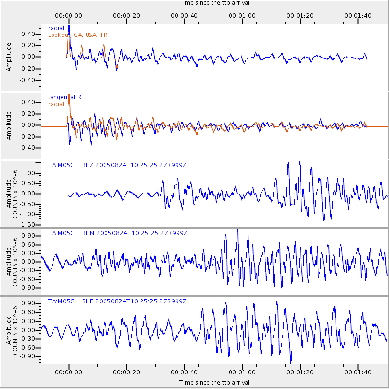
Signal To Noise
| Channel | StoN | STA | LTA |
| TA:M05C: :BHN:20050824T10:25:25.273999Z | 1.0267471 | 1.2508154E-7 | 1.2182312E-7 |
| TA:M05C: :BHE:20050824T10:25:25.273999Z | 1.0886797 | 1.7336446E-7 | 1.5924284E-7 |
| TA:M05C: :BHZ:20050824T10:25:25.273999Z | 3.321283 | 3.256524E-7 | 9.805017E-8 |
| Arrivals |
| Ps | 7.5 SECOND |
| PpPs | 23 SECOND |
| PsPs/PpSs | 31 SECOND |


