You are here: Home > Network List > US - United States National Seismic Network Stations List
> Station HAWA Hanford, Washington, USA > Earthquake Result Viewer
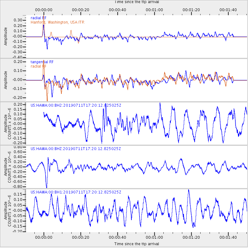
HAWA Hanford, Washington, USA - Earthquake Result Viewer
*The percent match for this event was below the threshold and hence no stack was calculated.
| Earthquake location: |
Solomon Islands |
| Earthquake latitude/longitude: |
-4.7/155.2 |
| Earthquake time(UTC): |
2019/07/11 (192) 17:08:37 GMT |
| Earthquake Depth: |
496 km |
| Earthquake Magnitude: |
6.0 Mww |
| Earthquake Catalog/Contributor: |
NEIC PDE/us |
|
| Network: |
US United States National Seismic Network |
| Station: |
HAWA Hanford, Washington, USA |
| Lat/Lon: |
46.39 N/119.53 W |
| Elevation: |
364 m |
|
| Distance: |
90.0 deg |
| Az: |
43.609 deg |
| Baz: |
263.352 deg |
| Ray Param: |
$rayparam |
*The percent match for this event was below the threshold and hence was not used in the summary stack. |
|
| Radial Match: |
49.963543 % |
| Radial Bump: |
400 |
| Transverse Match: |
52.459206 % |
| Transverse Bump: |
400 |
| SOD ConfigId: |
19053131 |
| Insert Time: |
2019-07-25 17:17:07.435 +0000 |
| GWidth: |
2.5 |
| Max Bumps: |
400 |
| Tol: |
0.001 |
|
Signal To Noise
| Channel | StoN | STA | LTA |
| US:HAWA:00:BHZ:20190711T17:20:12.825025Z | 3.4635694 | 3.1908098E-7 | 9.212489E-8 |
| US:HAWA:00:BH1:20190711T17:20:12.825025Z | 1.4359396 | 7.2897244E-8 | 5.0766236E-8 |
| US:HAWA:00:BH2:20190711T17:20:12.825025Z | 1.8100642 | 1.0502668E-7 | 5.802373E-8 |
| Arrivals |
| Ps | |
| PpPs | |
| PsPs/PpSs | |


