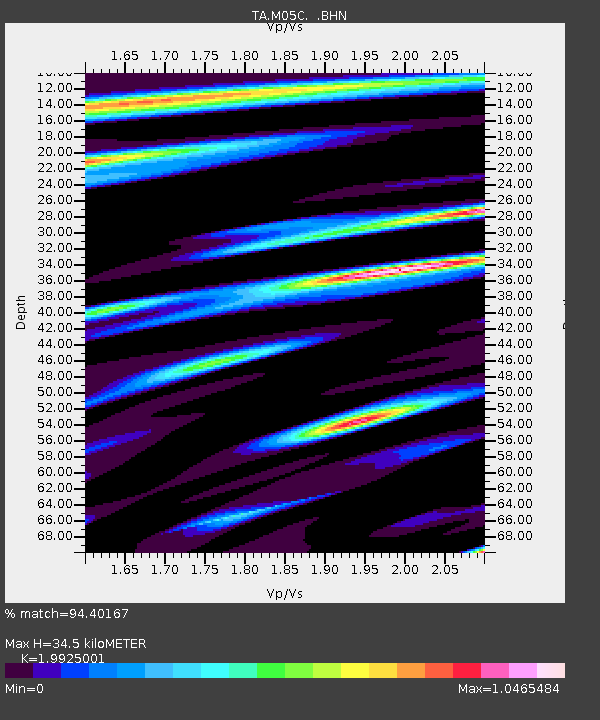
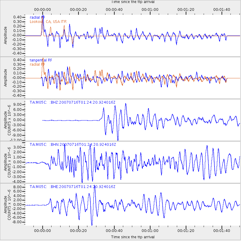
M05C Lookout, CA, USA - Earthquake Result Viewer

Earthquake location: Near West Coast Of Honshu, Japan
Earthquake latitude/longitude: 37.5/138.4
Earthquake time(UTC): 2007/07/16 (197) 01:13:22 GMT
Earthquake Depth: 12 km
Earthquake Magnitude: 6.5 MB, 6.4 MS, 6.6 MW, 6.5 MW
Earthquake Catalog/Contributor: WHDF/NEIC
Network: TA USArray Transportable Network (new EarthScope stations)
Station: M05C Lookout, CA, USA
Lat/Lon: 41.36 N/121.15 W
Elevation: 1333 m
Distance: 73.1 deg
Az: 50.71 deg
Baz: 305.184 deg
Ray Param: 0.053243678
Estimated Moho Depth: 34.5 km
Estimated Crust Vp/Vs: 1.99
Assumed Crust Vp: 6.566 km/s
Estimated Crust Vs: 3.295 km/s
Estimated Crust Poisson's Ratio: 0.33
Radial Match: 94.40167 %
Radial Bump: 400
Transverse Match: 86.96975 %
Transverse Bump: 400
SOD ConfigId: 2564
Insert Time: 2010-03-07 01:37:06.551 +0000
GWidth: 2.5
Max Bumps: 400
Tol: 0.001

Signal To Noise

ChannelStoNSTALTA
TA:M05C: :BHN:20070716T01:24:20.924016Z5.9841484.973063E-78.310395E-8
TA:M05C: :BHE:20070716T01:24:20.924016Z10.0368559.988363E-79.951687E-8
TA:M05C: :BHZ:20070716T01:24:20.924016Z26.4456182.512798E-69.5017555E-8
Arrivals
Ps5.4 SECOND
PpPs15 SECOND
PsPs/PpSs21 SECOND