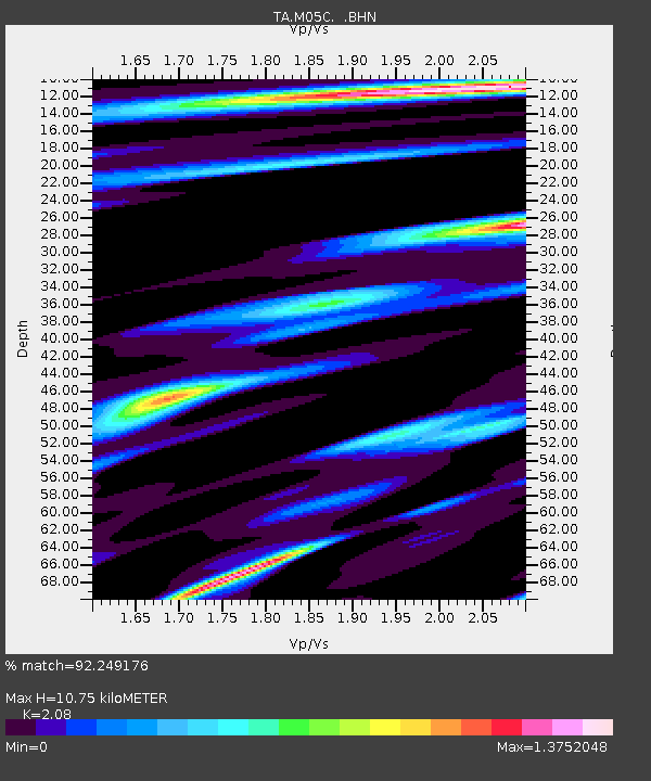
M05C Lookout, CA, USA - Earthquake Result Viewer
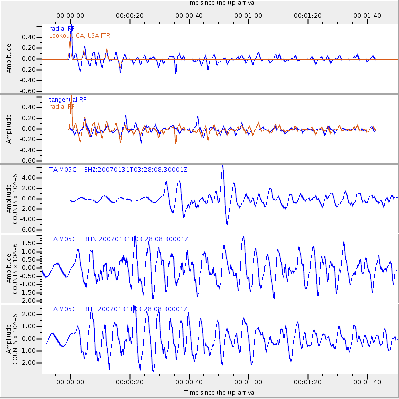
Earthquake location: Kermadec Islands, New Zealand
Earthquake latitude/longitude: -29.8/-178.0
Earthquake time(UTC): 2007/01/31 (031) 03:15:52 GMT
Earthquake Depth: 34 km
Earthquake Magnitude: 6.1 MB, 6.3 MS, 6.5 MW, 6.4 MW
Earthquake Catalog/Contributor: WHDF/NEIC
Network: TA USArray Transportable Network (new EarthScope stations)
Station: M05C Lookout, CA, USA
Lat/Lon: 41.36 N/121.15 W
Elevation: 1333 m
Distance: 88.1 deg
Az: 39.097 deg
Baz: 226.747 deg
Ray Param: 0.042768694
Estimated Moho Depth: 10.75 km
Estimated Crust Vp/Vs: 2.08
Assumed Crust Vp: 6.566 km/s
Estimated Crust Vs: 3.157 km/s
Estimated Crust Poisson's Ratio: 0.35
Radial Match: 92.249176 %
Radial Bump: 336
Transverse Match: 75.765495 %
Transverse Bump: 366
SOD ConfigId: 2564
Insert Time: 2010-03-07 01:37:17.759 +0000
GWidth: 2.5
Max Bumps: 400
Tol: 0.001

Signal To Noise

ChannelStoNSTALTA
TA:M05C: :BHN:20070131T03:28:08.30001Z1.6441116.178203E-73.7577774E-7
TA:M05C: :BHE:20070131T03:28:08.30001Z3.13392547.556927E-72.4113297E-7
TA:M05C: :BHZ:20070131T03:28:08.30001Z4.86398551.7129729E-63.5217474E-7
Arrivals
Ps1.8 SECOND
PpPs4.9 SECOND
PsPs/PpSs6.7 SECOND