
M05C Lookout, CA, USA - Earthquake Result Viewer
| ||||||||||||||||||
| ||||||||||||||||||
| ||||||||||||||||||
|
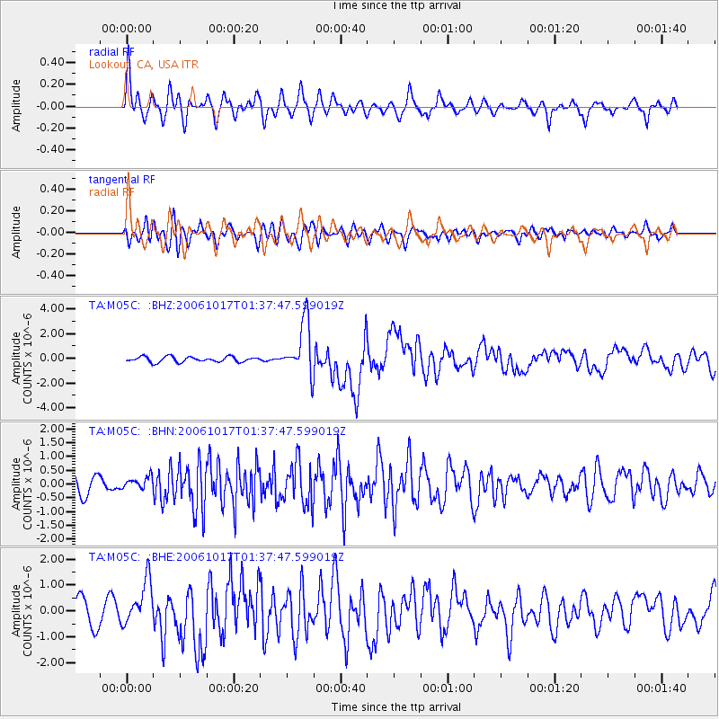
Signal To Noise
| Channel | StoN | STA | LTA |
| TA:M05C: :BHN:20061017T01:37:47.599019Z | 0.52400184 | 2.2799827E-7 | 4.3510965E-7 |
| TA:M05C: :BHE:20061017T01:37:47.599019Z | 2.2471707 | 8.748896E-7 | 3.8932941E-7 |
| TA:M05C: :BHZ:20061017T01:37:47.599019Z | 10.272387 | 2.203503E-6 | 2.1450741E-7 |
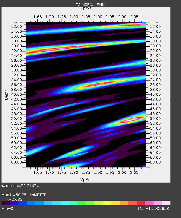
| Arrivals | |
| Ps | 8.1 SECOND |
| PpPs | 23 SECOND |
| PsPs/PpSs | 31 SECOND |

