You are here: Home > Network List > US - United States National Seismic Network Stations List
> Station EGMT Eagleton, Montana, USA > Earthquake Result Viewer
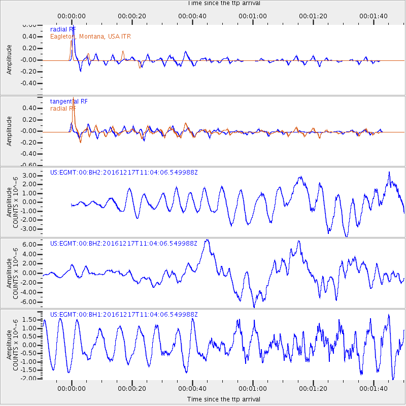
EGMT Eagleton, Montana, USA - Earthquake Result Viewer
*The percent match for this event was below the threshold and hence no stack was calculated.
| Earthquake location: |
New Ireland Region, P.N.G. |
| Earthquake latitude/longitude: |
-4.5/153.6 |
| Earthquake time(UTC): |
2016/12/17 (352) 10:51:11 GMT |
| Earthquake Depth: |
73 km |
| Earthquake Magnitude: |
8.0 Mi |
| Earthquake Catalog/Contributor: |
NEIC PDE/pt |
|
| Network: |
US United States National Seismic Network |
| Station: |
EGMT Eagleton, Montana, USA |
| Lat/Lon: |
48.02 N/109.75 W |
| Elevation: |
1055 m |
|
| Distance: |
97.8 deg |
| Az: |
42.294 deg |
| Baz: |
271.954 deg |
| Ray Param: |
$rayparam |
*The percent match for this event was below the threshold and hence was not used in the summary stack. |
|
| Radial Match: |
74.594505 % |
| Radial Bump: |
385 |
| Transverse Match: |
51.303925 % |
| Transverse Bump: |
400 |
| SOD ConfigId: |
1894071 |
| Insert Time: |
2016-12-31 10:53:54.250 +0000 |
| GWidth: |
2.5 |
| Max Bumps: |
400 |
| Tol: |
0.001 |
|
Signal To Noise
| Channel | StoN | STA | LTA |
| US:EGMT:00:BHZ:20161217T11:04:06.549988Z | 2.9656584 | 1.0796794E-6 | 3.6406058E-7 |
| US:EGMT:00:BH1:20161217T11:04:06.549988Z | 1.5845479 | 9.769874E-7 | 6.165717E-7 |
| US:EGMT:00:BH2:20161217T11:04:06.549988Z | 1.3563774 | 8.8227995E-7 | 6.504679E-7 |
| Arrivals |
| Ps | |
| PpPs | |
| PsPs/PpSs | |


