You are here: Home > Network List > AV - Alaska Volcano Observatory Stations List
> Station SPCR Ckakachatna River, Mount Spurr, Alaska > Earthquake Result Viewer
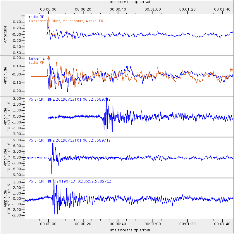
SPCR Ckakachatna River, Mount Spurr, Alaska - Earthquake Result Viewer
*The percent match for this event was below the threshold and hence no stack was calculated.
| Earthquake location: |
Northwest Of Ryukyu Islands |
| Earthquake latitude/longitude: |
29.4/128.2 |
| Earthquake time(UTC): |
2019/07/13 (194) 00:57:44 GMT |
| Earthquake Depth: |
251 km |
| Earthquake Magnitude: |
6.1 Mww |
| Earthquake Catalog/Contributor: |
NEIC PDE/us |
|
| Network: |
AV Alaska Volcano Observatory |
| Station: |
SPCR Ckakachatna River, Mount Spurr, Alaska |
| Lat/Lon: |
61.20 N/152.21 W |
| Elevation: |
984 m |
|
| Distance: |
59.8 deg |
| Az: |
33.438 deg |
| Baz: |
276.561 deg |
| Ray Param: |
$rayparam |
*The percent match for this event was below the threshold and hence was not used in the summary stack. |
|
| Radial Match: |
72.84385 % |
| Radial Bump: |
400 |
| Transverse Match: |
63.034824 % |
| Transverse Bump: |
400 |
| SOD ConfigId: |
19053131 |
| Insert Time: |
2019-07-27 01:00:29.595 +0000 |
| GWidth: |
2.5 |
| Max Bumps: |
400 |
| Tol: |
0.001 |
|
Signal To Noise
| Channel | StoN | STA | LTA |
| AV:SPCR: :BHZ:20190713T01:06:52.558971Z | 22.619581 | 3.3616197E-6 | 1.4861547E-7 |
| AV:SPCR: :BHN:20190713T01:06:52.558971Z | 6.714096 | 1.2015428E-6 | 1.7895823E-7 |
| AV:SPCR: :BHE:20190713T01:06:52.558971Z | 10.173386 | 1.2431074E-6 | 1.221921E-7 |
| Arrivals |
| Ps | |
| PpPs | |
| PsPs/PpSs | |


