You are here: Home > Network List > CI - Caltech Regional Seismic Network Stations List
> Station SMM Simmler, CA, USA > Earthquake Result Viewer
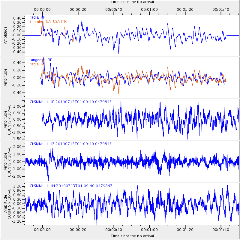
SMM Simmler, CA, USA - Earthquake Result Viewer
*The percent match for this event was below the threshold and hence no stack was calculated.
| Earthquake location: |
Northwest Of Ryukyu Islands |
| Earthquake latitude/longitude: |
29.4/128.2 |
| Earthquake time(UTC): |
2019/07/13 (194) 00:57:44 GMT |
| Earthquake Depth: |
251 km |
| Earthquake Magnitude: |
6.1 Mww |
| Earthquake Catalog/Contributor: |
NEIC PDE/us |
|
| Network: |
CI Caltech Regional Seismic Network |
| Station: |
SMM Simmler, CA, USA |
| Lat/Lon: |
35.31 N/120.00 W |
| Elevation: |
599 m |
|
| Distance: |
89.1 deg |
| Az: |
49.389 deg |
| Baz: |
305.867 deg |
| Ray Param: |
$rayparam |
*The percent match for this event was below the threshold and hence was not used in the summary stack. |
|
| Radial Match: |
58.368298 % |
| Radial Bump: |
400 |
| Transverse Match: |
60.65366 % |
| Transverse Bump: |
400 |
| SOD ConfigId: |
19053131 |
| Insert Time: |
2019-07-27 01:01:57.382 +0000 |
| GWidth: |
2.5 |
| Max Bumps: |
400 |
| Tol: |
0.001 |
|
Signal To Noise
| Channel | StoN | STA | LTA |
| CI:SMM: :HHZ:20190713T01:09:40.047984Z | 2.9704723 | 9.230764E-7 | 3.1075072E-7 |
| CI:SMM: :HHN:20190713T01:09:40.047984Z | 0.90195584 | 3.4144617E-7 | 3.7856196E-7 |
| CI:SMM: :HHE:20190713T01:09:40.047984Z | 1.1414282 | 3.4571718E-7 | 3.0288123E-7 |
| Arrivals |
| Ps | |
| PpPs | |
| PsPs/PpSs | |


