You are here: Home > Network List > TA - USArray Transportable Network (new EarthScope stations) Stations List
> Station G08A Pilot Rock, OR, USA > Earthquake Result Viewer
G08A Pilot Rock, OR, USA - Earthquake Result Viewer

| Earthquake location: |
Near Coast Of Guatemala |
| Earthquake latitude/longitude: |
13.8/-90.8 |
| Earthquake time(UTC): |
2007/06/08 (159) 13:32:00 GMT |
| Earthquake Depth: |
48 km |
| Earthquake Magnitude: |
5.5 MB, 5.4 MS, 5.8 MW, 5.8 MW |
| Earthquake Catalog/Contributor: |
WHDF/NEIC |
|
| Network: |
TA USArray Transportable Network (new EarthScope stations) |
| Station: |
G08A Pilot Rock, OR, USA |
| Lat/Lon: |
45.29 N/118.96 W |
| Elevation: |
1318 m |
|
| Distance: |
39.4 deg |
| Az: |
328.31 deg |
| Baz: |
133.707 deg |
| Ray Param: |
0.07488106 |
| Estimated Moho Depth: |
27.5 km |
| Estimated Crust Vp/Vs: |
1.68 |
| Assumed Crust Vp: |
6.571 km/s |
| Estimated Crust Vs: |
3.923 km/s |
| Estimated Crust Poisson's Ratio: |
0.22 |
|
| Radial Match: |
81.71533 % |
| Radial Bump: |
371 |
| Transverse Match: |
49.135563 % |
| Transverse Bump: |
400 |
| SOD ConfigId: |
2564 |
| Insert Time: |
2010-03-07 01:41:24.136 +0000 |
| GWidth: |
2.5 |
| Max Bumps: |
400 |
| Tol: |
0.001 |
|
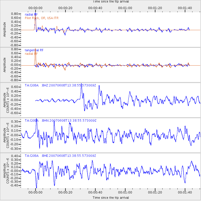
Signal To Noise
| Channel | StoN | STA | LTA |
| TA:G08A: :BHN:20070608T13:38:55.573009Z | 4.3583574 | 1.559384E-7 | 3.5779166E-8 |
| TA:G08A: :BHE:20070608T13:38:55.573009Z | 6.8491616 | 2.0476148E-7 | 2.9895844E-8 |
| TA:G08A: :BHZ:20070608T13:38:55.573009Z | 10.223843 | 3.5223675E-7 | 3.4452484E-8 |
| Arrivals |
| Ps | 3.1 SECOND |
| PpPs | 10 SECOND |
| PsPs/PpSs | 13 SECOND |


