You are here: Home > Network List > PF - Volcanologic Network of Piton de Fournaise-OVPF Stations List
> Station FRE Station Sismologique des Fonds de la Riviere de l'Est > Earthquake Result Viewer
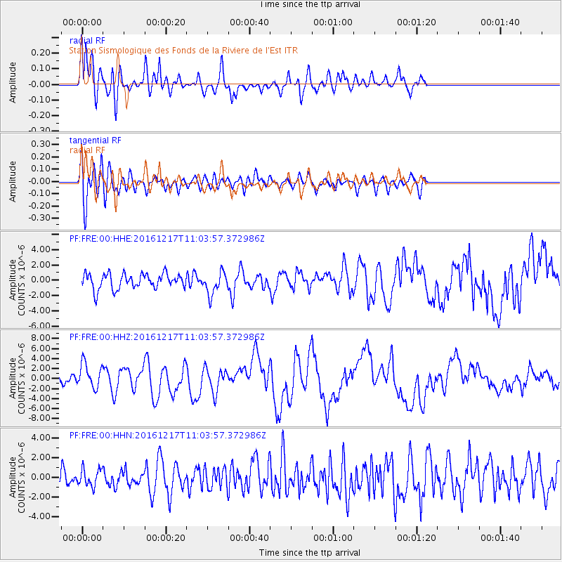
FRE Station Sismologique des Fonds de la Riviere de l'Est - Earthquake Result Viewer
*The percent match for this event was below the threshold and hence no stack was calculated.
| Earthquake location: |
New Ireland Region, P.N.G. |
| Earthquake latitude/longitude: |
-4.5/153.6 |
| Earthquake time(UTC): |
2016/12/17 (352) 10:51:11 GMT |
| Earthquake Depth: |
73 km |
| Earthquake Magnitude: |
8.0 Mi |
| Earthquake Catalog/Contributor: |
NEIC PDE/pt |
|
| Network: |
PF Volcanologic Network of Piton de Fournaise-OVPF |
| Station: |
FRE Station Sismologique des Fonds de la Riviere de l'Est |
| Lat/Lon: |
21.20 S/55.70 E |
| Elevation: |
1775 m |
|
| Distance: |
95.7 deg |
| Az: |
248.27 deg |
| Baz: |
97.012 deg |
| Ray Param: |
$rayparam |
*The percent match for this event was below the threshold and hence was not used in the summary stack. |
|
| Radial Match: |
84.556305 % |
| Radial Bump: |
400 |
| Transverse Match: |
77.57387 % |
| Transverse Bump: |
400 |
| SOD ConfigId: |
1894071 |
| Insert Time: |
2016-12-31 10:55:29.372 +0000 |
| GWidth: |
2.5 |
| Max Bumps: |
400 |
| Tol: |
0.001 |
|
Signal To Noise
| Channel | StoN | STA | LTA |
| PF:FRE:00:HHZ:20161217T11:03:57.372986Z | 2.5985017 | 2.5572422E-6 | 9.841218E-7 |
| PF:FRE:00:HHN:20161217T11:03:57.372986Z | 1.1183167 | 8.9924686E-7 | 8.041076E-7 |
| PF:FRE:00:HHE:20161217T11:03:57.372986Z | 1.5284307 | 1.5032924E-6 | 9.835529E-7 |
| Arrivals |
| Ps | |
| PpPs | |
| PsPs/PpSs | |


