G08A Pilot Rock, OR, USA - Earthquake Result Viewer
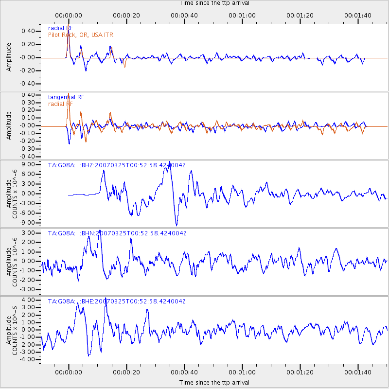
Earthquake location: Near West Coast Of Honshu, Japan
Earthquake latitude/longitude: 37.3/136.6
Earthquake time(UTC): 2007/03/25 (084) 00:41:57 GMT
Earthquake Depth: 8.0 km
Earthquake Magnitude: 6.1 MB, 6.8 MS, 6.7 MW, 6.6 MW
Earthquake Catalog/Contributor: WHDF/NEIC
Network: TA USArray Transportable Network (new EarthScope stations)
Station: G08A Pilot Rock, OR, USA
Lat/Lon: 45.29 N/118.96 W
Elevation: 1318 m
Distance: 73.3 deg
Az: 45.533 deg
Baz: 306.311 deg
Ray Param: 0.05309811
Estimated Moho Depth: 35.75 km
Estimated Crust Vp/Vs: 1.75
Assumed Crust Vp: 6.571 km/s
Estimated Crust Vs: 3.76 km/s
Estimated Crust Poisson's Ratio: 0.26
Radial Match: 89.83744 %
Radial Bump: 400
Transverse Match: 76.45983 %
Transverse Bump: 400
SOD ConfigId: 2564
Insert Time: 2010-03-07 01:41:35.060 +0000
GWidth: 2.5
Max Bumps: 400
Tol: 0.001

Signal To Noise

ChannelStoNSTALTA
TA:G08A: :BHN:20070325T00:52:58.424004Z1.91912068.9232765E-74.6496694E-7
TA:G08A: :BHE:20070325T00:52:58.424004Z2.0470181.994722E-69.744525E-7
TA:G08A: :BHZ:20070325T00:52:58.424004Z2.00906925.4950206E-62.7351075E-6
Arrivals
Ps4.2 SECOND
PpPs14 SECOND
PsPs/PpSs19 SECOND