You are here: Home > Network List > UU - University of Utah Regional Network Stations List
> Station FORU South Mineral Mountains, UT, USA > Earthquake Result Viewer
FORU South Mineral Mountains, UT, USA - Earthquake Result Viewer
*The percent match for this event was below the threshold and hence no stack was calculated.
| Earthquake location: |
Northwest Of Ryukyu Islands |
| Earthquake latitude/longitude: |
29.4/128.2 |
| Earthquake time(UTC): |
2019/07/13 (194) 00:57:44 GMT |
| Earthquake Depth: |
251 km |
| Earthquake Magnitude: |
6.1 Mww |
| Earthquake Catalog/Contributor: |
NEIC PDE/us |
|
| Network: |
UU University of Utah Regional Network |
| Station: |
FORU South Mineral Mountains, UT, USA |
| Lat/Lon: |
38.46 N/112.86 W |
| Elevation: |
1840 m |
|
| Distance: |
91.7 deg |
| Az: |
43.398 deg |
| Baz: |
310.181 deg |
| Ray Param: |
$rayparam |
*The percent match for this event was below the threshold and hence was not used in the summary stack. |
|
| Radial Match: |
66.88056 % |
| Radial Bump: |
400 |
| Transverse Match: |
52.901573 % |
| Transverse Bump: |
335 |
| SOD ConfigId: |
19053131 |
| Insert Time: |
2019-07-27 01:08:22.919 +0000 |
| GWidth: |
2.5 |
| Max Bumps: |
400 |
| Tol: |
0.001 |
|
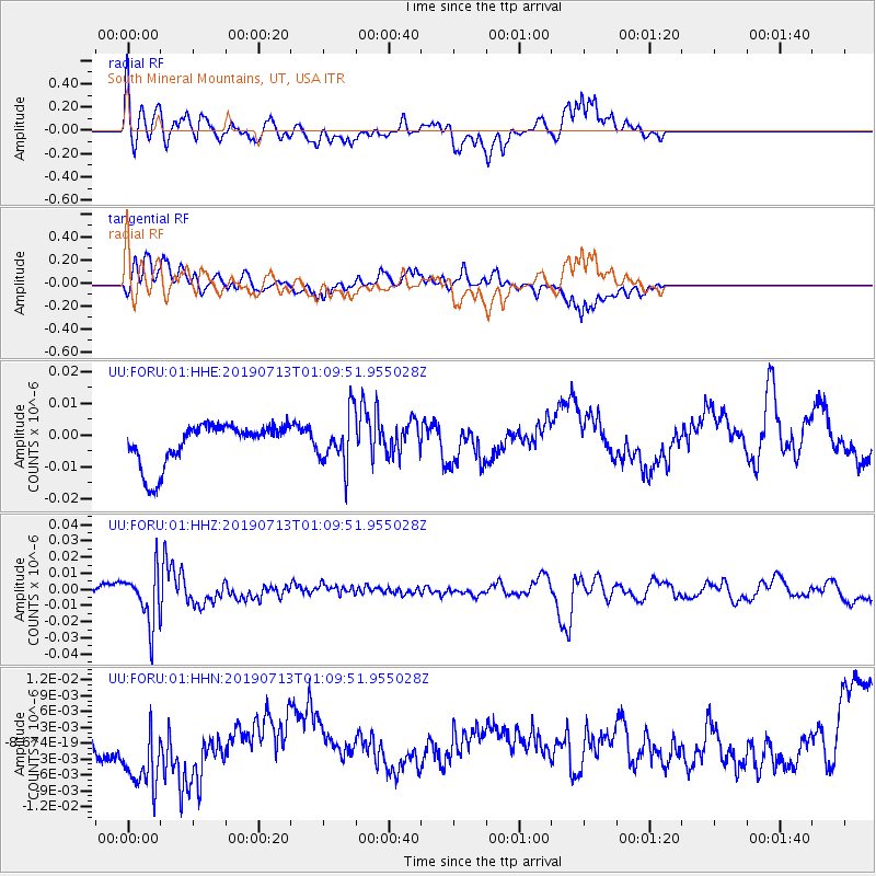
Signal To Noise
| Channel | StoN | STA | LTA |
| UU:FORU:01:HHZ:20190713T01:09:51.955028Z | 7.918817 | 1.631963E-8 | 2.0608673E-9 |
| UU:FORU:01:HHN:20190713T01:09:51.955028Z | 2.9747908 | 8.421344E-9 | 2.8309028E-9 |
| UU:FORU:01:HHE:20190713T01:09:51.955028Z | 1.2257028 | 7.951997E-9 | 6.4877037E-9 |
| Arrivals |
| Ps | |
| PpPs | |
| PsPs/PpSs | |


