You are here: Home > Network List > UU - University of Utah Regional Network Stations List
> Station CCUT Cedar City, UT, USA > Earthquake Result Viewer
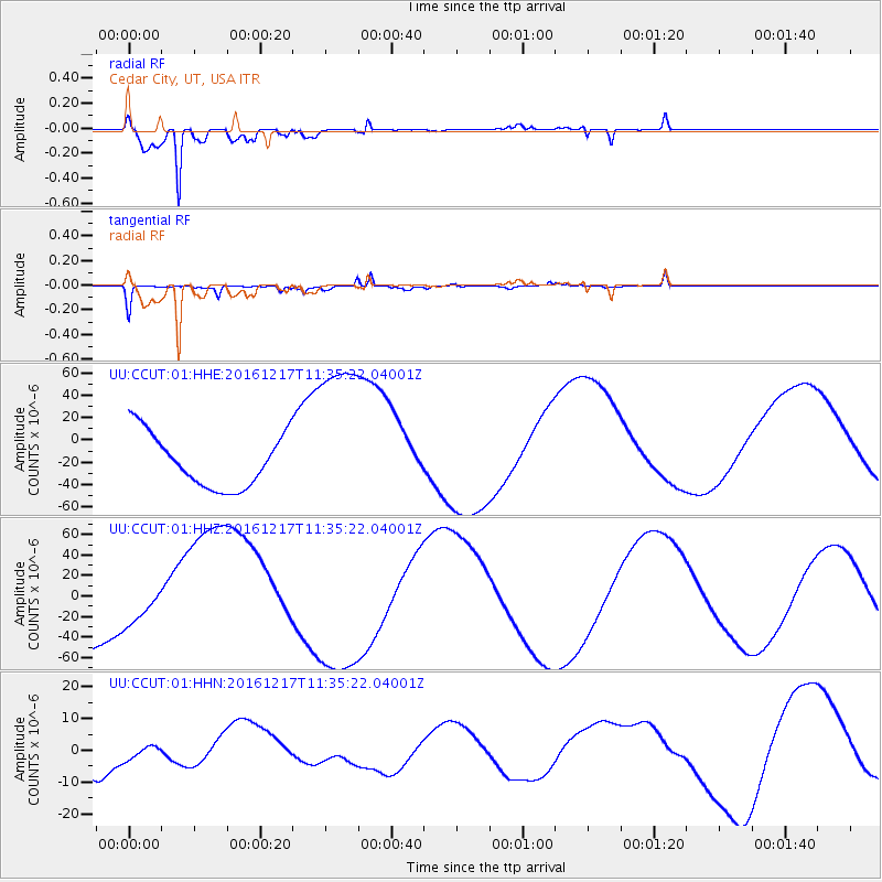
CCUT Cedar City, UT, USA - Earthquake Result Viewer
*The percent match for this event was below the threshold and hence no stack was calculated.
| Earthquake location: |
New Ireland Region, P.N.G. |
| Earthquake latitude/longitude: |
-4.4/153.5 |
| Earthquake time(UTC): |
2016/12/17 (352) 11:22:39 GMT |
| Earthquake Depth: |
83 km |
| Earthquake Magnitude: |
5.6 mb |
| Earthquake Catalog/Contributor: |
NEIC PDE/us |
|
| Network: |
UU University of Utah Regional Network |
| Station: |
CCUT Cedar City, UT, USA |
| Lat/Lon: |
37.55 N/113.36 W |
| Elevation: |
2127 m |
|
| Distance: |
95.1 deg |
| Az: |
52.827 deg |
| Baz: |
268.376 deg |
| Ray Param: |
$rayparam |
*The percent match for this event was below the threshold and hence was not used in the summary stack. |
|
| Radial Match: |
97.86741 % |
| Radial Bump: |
294 |
| Transverse Match: |
79.67307 % |
| Transverse Bump: |
320 |
| SOD ConfigId: |
1894071 |
| Insert Time: |
2016-12-31 11:24:45.780 +0000 |
| GWidth: |
2.5 |
| Max Bumps: |
400 |
| Tol: |
0.001 |
|
Signal To Noise
| Channel | StoN | STA | LTA |
| UU:CCUT:01:HHZ:20161217T11:35:22.04001Z | 0.50116646 | 2.1066817E-5 | 4.203557E-5 |
| UU:CCUT:01:HHN:20161217T11:35:22.04001Z | 0.44630858 | 3.0230606E-6 | 6.773476E-6 |
| UU:CCUT:01:HHE:20161217T11:35:22.04001Z | 3.2034812 | 7.6672506E-5 | 2.393412E-5 |
| Arrivals |
| Ps | |
| PpPs | |
| PsPs/PpSs | |


