You are here: Home > Network List > PF - Volcanologic Network of Piton de Fournaise-OVPF Stations List
> Station HIM cratere Himiltrude > Earthquake Result Viewer
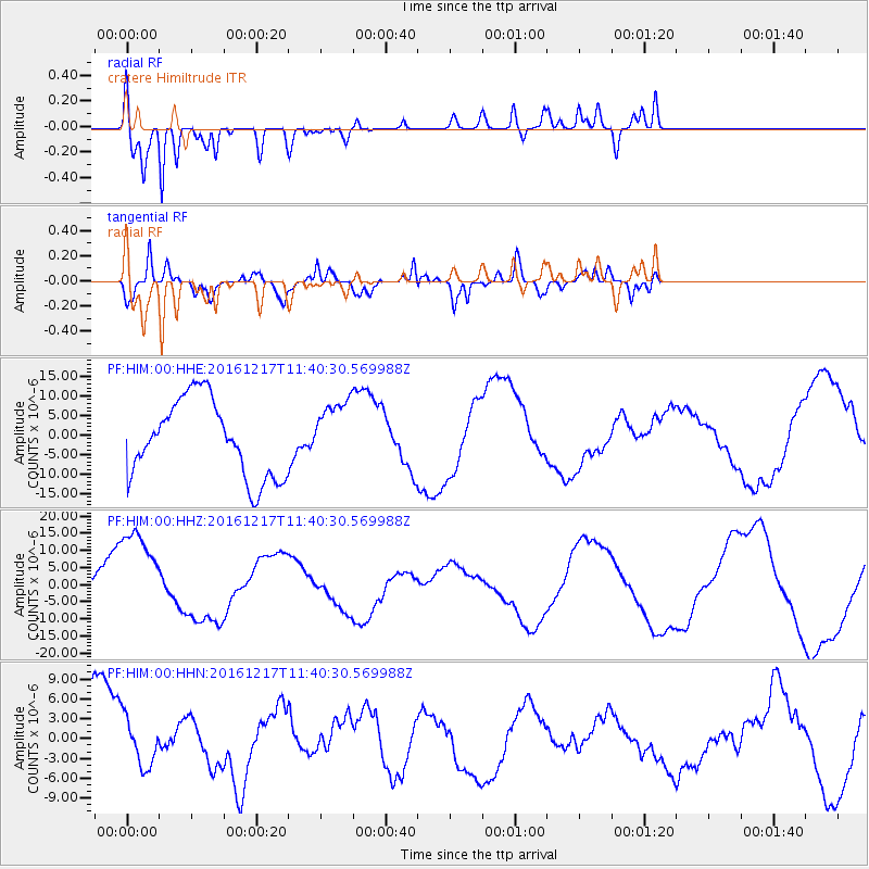
HIM cratere Himiltrude - Earthquake Result Viewer
*The percent match for this event was below the threshold and hence no stack was calculated.
| Earthquake location: |
New Ireland Region, P.N.G. |
| Earthquake latitude/longitude: |
-5.7/153.9 |
| Earthquake time(UTC): |
2016/12/17 (352) 11:27:41 GMT |
| Earthquake Depth: |
40 km |
| Earthquake Magnitude: |
6.0 mb |
| Earthquake Catalog/Contributor: |
NEIC PDE/us |
|
| Network: |
PF Volcanologic Network of Piton de Fournaise-OVPF |
| Station: |
HIM cratere Himiltrude |
| Lat/Lon: |
21.21 S/55.72 E |
| Elevation: |
1958 m |
|
| Distance: |
95.6 deg |
| Az: |
248.108 deg |
| Baz: |
98.276 deg |
| Ray Param: |
$rayparam |
*The percent match for this event was below the threshold and hence was not used in the summary stack. |
|
| Radial Match: |
88.47837 % |
| Radial Bump: |
400 |
| Transverse Match: |
85.04417 % |
| Transverse Bump: |
400 |
| SOD ConfigId: |
1894071 |
| Insert Time: |
2016-12-31 11:32:20.422 +0000 |
| GWidth: |
2.5 |
| Max Bumps: |
400 |
| Tol: |
0.001 |
|
Signal To Noise
| Channel | StoN | STA | LTA |
| PF:HIM:00:HHZ:20161217T11:40:30.569988Z | 1.9262062 | 1.5177514E-5 | 7.879485E-6 |
| PF:HIM:00:HHN:20161217T11:40:30.569988Z | 0.5706221 | 3.6689537E-6 | 6.4297437E-6 |
| PF:HIM:00:HHE:20161217T11:40:30.569988Z | 0.8310585 | 8.233345E-6 | 9.9070585E-6 |
| Arrivals |
| Ps | |
| PpPs | |
| PsPs/PpSs | |


