You are here: Home > Network List > TA - USArray Transportable Network (new EarthScope stations) Stations List
> Station E20K Nigu River, AK, USA > Earthquake Result Viewer
E20K Nigu River, AK, USA - Earthquake Result Viewer

| Earthquake location: |
Mariana Islands |
| Earthquake latitude/longitude: |
19.9/144.3 |
| Earthquake time(UTC): |
2019/06/28 (179) 15:51:31 GMT |
| Earthquake Depth: |
410 km |
| Earthquake Magnitude: |
6.4 Mww |
| Earthquake Catalog/Contributor: |
NEIC PDE/us |
|
| Network: |
TA USArray Transportable Network (new EarthScope stations) |
| Station: |
E20K Nigu River, AK, USA |
| Lat/Lon: |
68.26 N/156.19 W |
| Elevation: |
866 m |
|
| Distance: |
60.6 deg |
| Az: |
21.622 deg |
| Baz: |
248.58 deg |
| Ray Param: |
0.059984803 |
| Estimated Moho Depth: |
39.75 km |
| Estimated Crust Vp/Vs: |
1.85 |
| Assumed Crust Vp: |
6.221 km/s |
| Estimated Crust Vs: |
3.363 km/s |
| Estimated Crust Poisson's Ratio: |
0.29 |
|
| Radial Match: |
90.05618 % |
| Radial Bump: |
400 |
| Transverse Match: |
76.78292 % |
| Transverse Bump: |
400 |
| SOD ConfigId: |
19053131 |
| Insert Time: |
2019-07-27 14:05:36.849 +0000 |
| GWidth: |
2.5 |
| Max Bumps: |
400 |
| Tol: |
0.001 |
|
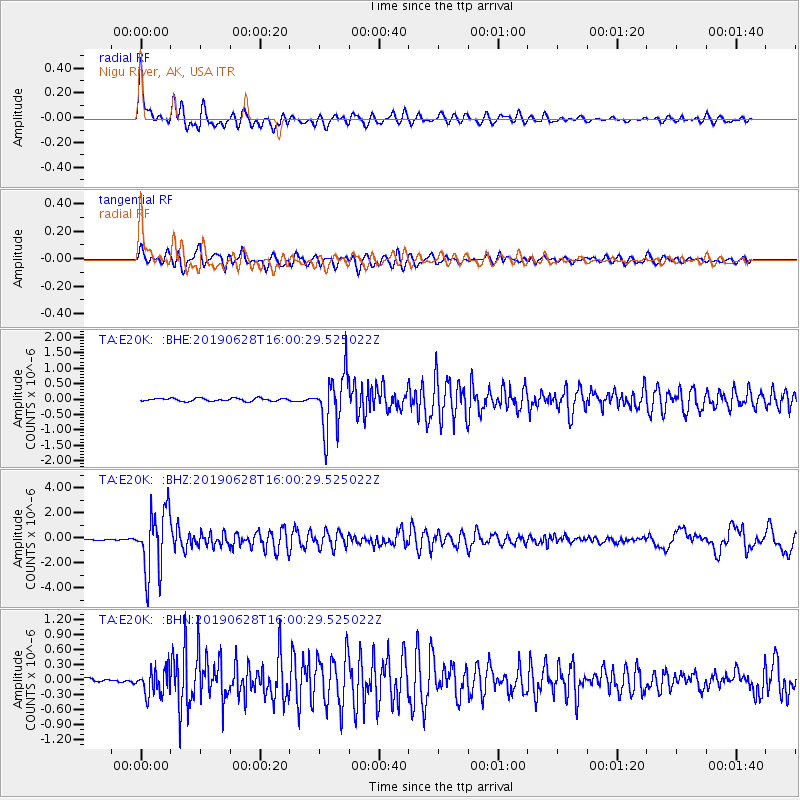
Signal To Noise
| Channel | StoN | STA | LTA |
| TA:E20K: :BHZ:20190628T16:00:29.525022Z | 44.636833 | 2.5312947E-6 | 5.6708657E-8 |
| TA:E20K: :BHN:20190628T16:00:29.525022Z | 6.033754 | 2.5661393E-7 | 4.252973E-8 |
| TA:E20K: :BHE:20190628T16:00:29.525022Z | 18.644941 | 9.009394E-7 | 4.8320853E-8 |
| Arrivals |
| Ps | 5.6 SECOND |
| PpPs | 18 SECOND |
| PsPs/PpSs | 23 SECOND |


