You are here: Home > Network List > TA - USArray Transportable Network (new EarthScope stations) Stations List
> Station G21K Allakaket, AK, USA > Earthquake Result Viewer
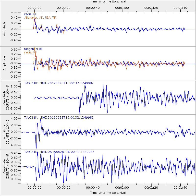
G21K Allakaket, AK, USA - Earthquake Result Viewer
*The percent match for this event was below the threshold and hence no stack was calculated.
| Earthquake location: |
Mariana Islands |
| Earthquake latitude/longitude: |
19.9/144.3 |
| Earthquake time(UTC): |
2019/06/28 (179) 15:51:31 GMT |
| Earthquake Depth: |
410 km |
| Earthquake Magnitude: |
6.4 Mww |
| Earthquake Catalog/Contributor: |
NEIC PDE/us |
|
| Network: |
TA USArray Transportable Network (new EarthScope stations) |
| Station: |
G21K Allakaket, AK, USA |
| Lat/Lon: |
66.52 N/153.51 W |
| Elevation: |
446 m |
|
| Distance: |
61.0 deg |
| Az: |
23.91 deg |
| Baz: |
252.173 deg |
| Ray Param: |
$rayparam |
*The percent match for this event was below the threshold and hence was not used in the summary stack. |
|
| Radial Match: |
72.105385 % |
| Radial Bump: |
400 |
| Transverse Match: |
81.488495 % |
| Transverse Bump: |
400 |
| SOD ConfigId: |
19053131 |
| Insert Time: |
2019-07-27 14:05:53.788 +0000 |
| GWidth: |
2.5 |
| Max Bumps: |
400 |
| Tol: |
0.001 |
|
Signal To Noise
| Channel | StoN | STA | LTA |
| TA:G21K: :BHZ:20190628T16:00:32.124998Z | 27.25869 | 2.1955482E-6 | 8.0544886E-8 |
| TA:G21K: :BHN:20190628T16:00:32.124998Z | 16.075125 | 5.3650916E-7 | 3.3375116E-8 |
| TA:G21K: :BHE:20190628T16:00:32.124998Z | 14.605282 | 6.154272E-7 | 4.21373E-8 |
| Arrivals |
| Ps | |
| PpPs | |
| PsPs/PpSs | |


