You are here: Home > Network List > US - United States National Seismic Network Stations List
> Station MSO Missoula, Montana, USA > Earthquake Result Viewer
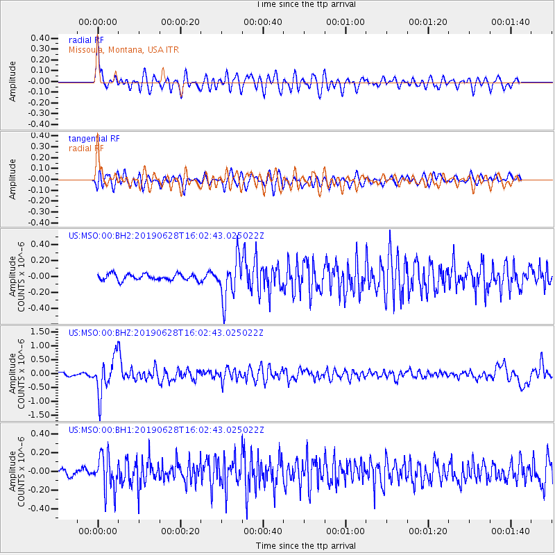
MSO Missoula, Montana, USA - Earthquake Result Viewer
*The percent match for this event was below the threshold and hence no stack was calculated.
| Earthquake location: |
Mariana Islands |
| Earthquake latitude/longitude: |
19.9/144.3 |
| Earthquake time(UTC): |
2019/06/28 (179) 15:51:31 GMT |
| Earthquake Depth: |
410 km |
| Earthquake Magnitude: |
6.4 Mww |
| Earthquake Catalog/Contributor: |
NEIC PDE/us |
|
| Network: |
US United States National Seismic Network |
| Station: |
MSO Missoula, Montana, USA |
| Lat/Lon: |
46.83 N/113.94 W |
| Elevation: |
1264 m |
|
| Distance: |
83.4 deg |
| Az: |
42.59 deg |
| Baz: |
291.909 deg |
| Ray Param: |
$rayparam |
*The percent match for this event was below the threshold and hence was not used in the summary stack. |
|
| Radial Match: |
67.281105 % |
| Radial Bump: |
400 |
| Transverse Match: |
67.90624 % |
| Transverse Bump: |
400 |
| SOD ConfigId: |
19053131 |
| Insert Time: |
2019-07-27 14:07:49.169 +0000 |
| GWidth: |
2.5 |
| Max Bumps: |
400 |
| Tol: |
0.001 |
|
Signal To Noise
| Channel | StoN | STA | LTA |
| US:MSO:00:BHZ:20190628T16:02:43.025022Z | 14.519209 | 6.914769E-7 | 4.762497E-8 |
| US:MSO:00:BH1:20190628T16:02:43.025022Z | 4.8622885 | 1.8930771E-7 | 3.8933873E-8 |
| US:MSO:00:BH2:20190628T16:02:43.025022Z | 6.686949 | 2.6213834E-7 | 3.920149E-8 |
| Arrivals |
| Ps | |
| PpPs | |
| PsPs/PpSs | |


