You are here: Home > Network List > UW - Pacific Northwest Regional Seismic Network Stations List
> Station HOOD Mt Hood Meadows, OR CREST BB SMO > Earthquake Result Viewer
HOOD Mt Hood Meadows, OR CREST BB SMO - Earthquake Result Viewer

| Earthquake location: |
Mariana Islands |
| Earthquake latitude/longitude: |
19.9/144.3 |
| Earthquake time(UTC): |
2019/06/28 (179) 15:51:31 GMT |
| Earthquake Depth: |
410 km |
| Earthquake Magnitude: |
6.4 Mww |
| Earthquake Catalog/Contributor: |
NEIC PDE/us |
|
| Network: |
UW Pacific Northwest Regional Seismic Network |
| Station: |
HOOD Mt Hood Meadows, OR CREST BB SMO |
| Lat/Lon: |
45.32 N/121.65 W |
| Elevation: |
1520 m |
|
| Distance: |
78.9 deg |
| Az: |
45.829 deg |
| Baz: |
286.866 deg |
| Ray Param: |
0.0481861 |
| Estimated Moho Depth: |
29.25 km |
| Estimated Crust Vp/Vs: |
2.05 |
| Assumed Crust Vp: |
6.597 km/s |
| Estimated Crust Vs: |
3.222 km/s |
| Estimated Crust Poisson's Ratio: |
0.34 |
|
| Radial Match: |
89.313385 % |
| Radial Bump: |
400 |
| Transverse Match: |
81.52628 % |
| Transverse Bump: |
400 |
| SOD ConfigId: |
19053131 |
| Insert Time: |
2019-07-27 14:08:20.284 +0000 |
| GWidth: |
2.5 |
| Max Bumps: |
400 |
| Tol: |
0.001 |
|
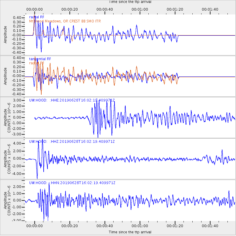
Signal To Noise
| Channel | StoN | STA | LTA |
| UW:HOOD: :HHZ:20190628T16:02:19.409971Z | 39.309875 | 2.370091E-6 | 6.02925E-8 |
| UW:HOOD: :HHN:20190628T16:02:19.409971Z | 9.371806 | 7.4622955E-7 | 7.962495E-8 |
| UW:HOOD: :HHE:20190628T16:02:19.409971Z | 13.620133 | 1.2485187E-6 | 9.166715E-8 |
| Arrivals |
| Ps | 4.8 SECOND |
| PpPs | 13 SECOND |
| PsPs/PpSs | 18 SECOND |


