You are here: Home > Network List > US - United States National Seismic Network Stations List
> Station HAWA Hanford, Washington, USA > Earthquake Result Viewer
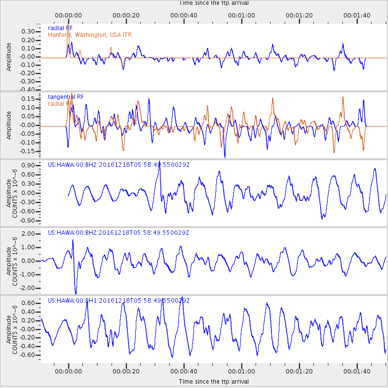
HAWA Hanford, Washington, USA - Earthquake Result Viewer
*The percent match for this event was below the threshold and hence no stack was calculated.
| Earthquake location: |
Solomon Islands |
| Earthquake latitude/longitude: |
-10.2/161.2 |
| Earthquake time(UTC): |
2016/12/18 (353) 05:46:25 GMT |
| Earthquake Depth: |
39 km |
| Earthquake Magnitude: |
6.0 Mwp |
| Earthquake Catalog/Contributor: |
NEIC PDE/us |
|
| Network: |
US United States National Seismic Network |
| Station: |
HAWA Hanford, Washington, USA |
| Lat/Lon: |
46.39 N/119.53 W |
| Elevation: |
364 m |
|
| Distance: |
90.0 deg |
| Az: |
42.847 deg |
| Baz: |
255.266 deg |
| Ray Param: |
$rayparam |
*The percent match for this event was below the threshold and hence was not used in the summary stack. |
|
| Radial Match: |
76.733025 % |
| Radial Bump: |
388 |
| Transverse Match: |
57.300774 % |
| Transverse Bump: |
400 |
| SOD ConfigId: |
1894071 |
| Insert Time: |
2017-01-01 05:53:31.925 +0000 |
| GWidth: |
2.5 |
| Max Bumps: |
400 |
| Tol: |
0.001 |
|
Signal To Noise
| Channel | StoN | STA | LTA |
| US:HAWA:00:BHZ:20161218T05:58:49.550029Z | 4.3789797 | 1.0183147E-6 | 2.325461E-7 |
| US:HAWA:00:BH1:20161218T05:58:49.550029Z | 0.7157529 | 1.677786E-7 | 2.3440856E-7 |
| US:HAWA:00:BH2:20161218T05:58:49.550029Z | 2.6535232 | 4.5075132E-7 | 1.69869E-7 |
| Arrivals |
| Ps | |
| PpPs | |
| PsPs/PpSs | |


