V11A Goodsprings, NV, USA - Earthquake Result Viewer
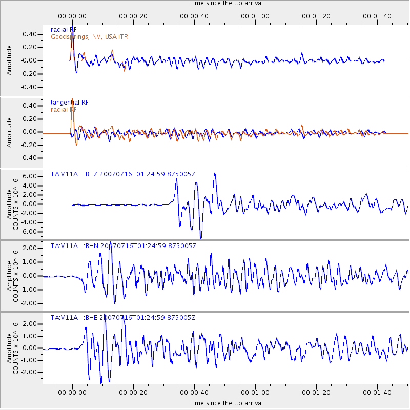
Earthquake location: Near West Coast Of Honshu, Japan
Earthquake latitude/longitude: 37.5/138.4
Earthquake time(UTC): 2007/07/16 (197) 01:13:22 GMT
Earthquake Depth: 12 km
Earthquake Magnitude: 6.5 MB, 6.4 MS, 6.6 MW, 6.5 MW
Earthquake Catalog/Contributor: WHDF/NEIC
Network: TA USArray Transportable Network (new EarthScope stations)
Station: V11A Goodsprings, NV, USA
Lat/Lon: 35.84 N/115.43 W
Elevation: 1117 m
Distance: 80.0 deg
Az: 52.439 deg
Baz: 309.145 deg
Ray Param: 0.048596635
Estimated Moho Depth: 30.0 km
Estimated Crust Vp/Vs: 1.82
Assumed Crust Vp: 6.276 km/s
Estimated Crust Vs: 3.453 km/s
Estimated Crust Poisson's Ratio: 0.28
Radial Match: 95.51288 %
Radial Bump: 400
Transverse Match: 89.950714 %
Transverse Bump: 400
SOD ConfigId: 2564
Insert Time: 2010-03-07 01:54:07.017 +0000
GWidth: 2.5
Max Bumps: 400
Tol: 0.001

Signal To Noise

ChannelStoNSTALTA
TA:V11A: :BHN:20070716T01:24:59.875005Z8.8202234.0103427E-74.5467587E-8
TA:V11A: :BHE:20070716T01:24:59.875005Z14.4121256.45498E-74.478854E-8
TA:V11A: :BHZ:20070716T01:24:59.875005Z31.7649751.91527E-66.029503E-8
Arrivals
Ps4.0 SECOND
PpPs13 SECOND
PsPs/PpSs17 SECOND