You are here: Home > Network List > TA - USArray Transportable Network (new EarthScope stations) Stations List
> Station V11A Goodsprings, NV, USA > Earthquake Result Viewer
V11A Goodsprings, NV, USA - Earthquake Result Viewer

| Earthquake location: |
Central Mid-Atlantic Ridge |
| Earthquake latitude/longitude: |
0.7/-30.3 |
| Earthquake time(UTC): |
2007/07/03 (184) 08:26:00 GMT |
| Earthquake Depth: |
10 km |
| Earthquake Magnitude: |
5.8 MB, 5.9 MS, 6.3 MW, 6.1 MW |
| Earthquake Catalog/Contributor: |
WHDF/NEIC |
|
| Network: |
TA USArray Transportable Network (new EarthScope stations) |
| Station: |
V11A Goodsprings, NV, USA |
| Lat/Lon: |
35.84 N/115.43 W |
| Elevation: |
1117 m |
|
| Distance: |
85.7 deg |
| Az: |
305.711 deg |
| Baz: |
92.249 deg |
| Ray Param: |
0.04461017 |
| Estimated Moho Depth: |
21.5 km |
| Estimated Crust Vp/Vs: |
2.10 |
| Assumed Crust Vp: |
6.276 km/s |
| Estimated Crust Vs: |
2.992 km/s |
| Estimated Crust Poisson's Ratio: |
0.35 |
|
| Radial Match: |
85.30682 % |
| Radial Bump: |
400 |
| Transverse Match: |
68.22628 % |
| Transverse Bump: |
400 |
| SOD ConfigId: |
2564 |
| Insert Time: |
2010-03-07 01:54:12.785 +0000 |
| GWidth: |
2.5 |
| Max Bumps: |
400 |
| Tol: |
0.001 |
|
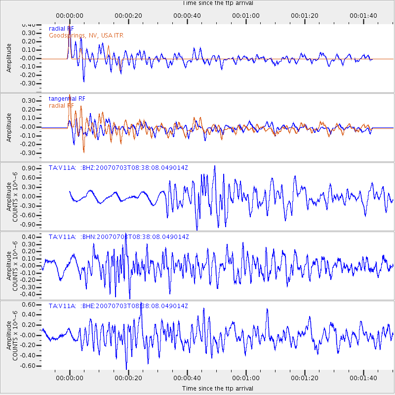
Signal To Noise
| Channel | StoN | STA | LTA |
| TA:V11A: :BHN:20070703T08:38:08.049014Z | 0.946268 | 9.3977675E-8 | 9.931401E-8 |
| TA:V11A: :BHE:20070703T08:38:08.049014Z | 1.964902 | 1.1414263E-7 | 5.8090748E-8 |
| TA:V11A: :BHZ:20070703T08:38:08.049014Z | 2.4956944 | 2.5902295E-7 | 1.0378793E-7 |
| Arrivals |
| Ps | 3.8 SECOND |
| PpPs | 10 SECOND |
| PsPs/PpSs | 14 SECOND |


