You are here: Home > Network List > US - United States National Seismic Network Stations List
> Station HAWA Hanford, Washington, USA > Earthquake Result Viewer
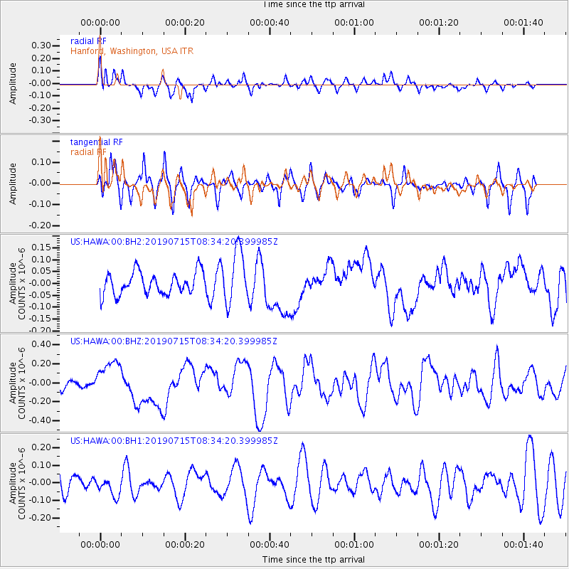
HAWA Hanford, Washington, USA - Earthquake Result Viewer
*The percent match for this event was below the threshold and hence no stack was calculated.
| Earthquake location: |
New Britain Region, P.N.G. |
| Earthquake latitude/longitude: |
-6.0/149.6 |
| Earthquake time(UTC): |
2019/07/15 (196) 08:21:35 GMT |
| Earthquake Depth: |
59 km |
| Earthquake Magnitude: |
6.2 Mww |
| Earthquake Catalog/Contributor: |
NEIC PDE/us |
|
| Network: |
US United States National Seismic Network |
| Station: |
HAWA Hanford, Washington, USA |
| Lat/Lon: |
46.39 N/119.53 W |
| Elevation: |
364 m |
|
| Distance: |
94.9 deg |
| Az: |
43.996 deg |
| Baz: |
266.531 deg |
| Ray Param: |
$rayparam |
*The percent match for this event was below the threshold and hence was not used in the summary stack. |
|
| Radial Match: |
60.421425 % |
| Radial Bump: |
400 |
| Transverse Match: |
42.953594 % |
| Transverse Bump: |
362 |
| SOD ConfigId: |
19053131 |
| Insert Time: |
2019-07-29 08:29:39.434 +0000 |
| GWidth: |
2.5 |
| Max Bumps: |
400 |
| Tol: |
0.001 |
|
Signal To Noise
| Channel | StoN | STA | LTA |
| US:HAWA:00:BHZ:20190715T08:34:20.399985Z | 2.3789341 | 1.9608312E-7 | 8.242478E-8 |
| US:HAWA:00:BH1:20190715T08:34:20.399985Z | 0.5124981 | 5.282628E-8 | 1.03076054E-7 |
| US:HAWA:00:BH2:20190715T08:34:20.399985Z | 2.4737737 | 1.1478343E-7 | 4.6400135E-8 |
| Arrivals |
| Ps | |
| PpPs | |
| PsPs/PpSs | |


