You are here: Home > Network List > TA - USArray Transportable Network (new EarthScope stations) Stations List
> Station TOLK Toolik Lake Research Station, AK, USA > Earthquake Result Viewer
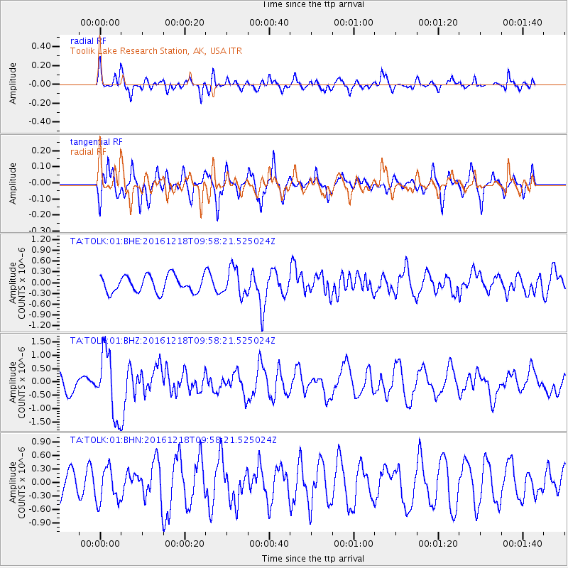
TOLK Toolik Lake Research Station, AK, USA - Earthquake Result Viewer
*The percent match for this event was below the threshold and hence no stack was calculated.
| Earthquake location: |
W. Caroline Islands, Micronesia |
| Earthquake latitude/longitude: |
8.3/137.7 |
| Earthquake time(UTC): |
2016/12/18 (353) 09:47:08 GMT |
| Earthquake Depth: |
29 km |
| Earthquake Magnitude: |
6.5 Mi |
| Earthquake Catalog/Contributor: |
NEIC PDE/at |
|
| Network: |
TA USArray Transportable Network (new EarthScope stations) |
| Station: |
TOLK Toolik Lake Research Station, AK, USA |
| Lat/Lon: |
68.64 N/149.57 W |
| Elevation: |
760 m |
|
| Distance: |
76.0 deg |
| Az: |
21.128 deg |
| Baz: |
256.845 deg |
| Ray Param: |
$rayparam |
*The percent match for this event was below the threshold and hence was not used in the summary stack. |
|
| Radial Match: |
71.002426 % |
| Radial Bump: |
400 |
| Transverse Match: |
51.41789 % |
| Transverse Bump: |
379 |
| SOD ConfigId: |
1894071 |
| Insert Time: |
2017-01-01 09:50:40.653 +0000 |
| GWidth: |
2.5 |
| Max Bumps: |
400 |
| Tol: |
0.001 |
|
Signal To Noise
| Channel | StoN | STA | LTA |
| TA:TOLK:01:BHZ:20161218T09:58:21.525024Z | 4.184601 | 1.2190717E-6 | 2.913233E-7 |
| TA:TOLK:01:BHN:20161218T09:58:21.525024Z | 1.2140857 | 3.8929133E-7 | 3.2064565E-7 |
| TA:TOLK:01:BHE:20161218T09:58:21.525024Z | 1.6926652 | 3.84311E-7 | 2.270449E-7 |
| Arrivals |
| Ps | |
| PpPs | |
| PsPs/PpSs | |


