You are here: Home > Network List > PF - Volcanologic Network of Piton de Fournaise-OVPF Stations List
> Station CIL Cilaos (Pompiers) > Earthquake Result Viewer
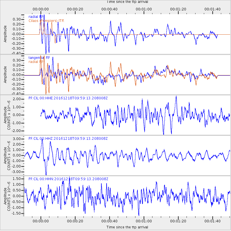
CIL Cilaos (Pompiers) - Earthquake Result Viewer
*The percent match for this event was below the threshold and hence no stack was calculated.
| Earthquake location: |
W. Caroline Islands, Micronesia |
| Earthquake latitude/longitude: |
8.3/137.7 |
| Earthquake time(UTC): |
2016/12/18 (353) 09:47:08 GMT |
| Earthquake Depth: |
29 km |
| Earthquake Magnitude: |
6.5 Mi |
| Earthquake Catalog/Contributor: |
NEIC PDE/at |
|
| Network: |
PF Volcanologic Network of Piton de Fournaise-OVPF |
| Station: |
CIL Cilaos (Pompiers) |
| Lat/Lon: |
21.13 S/55.47 E |
| Elevation: |
1223 m |
|
| Distance: |
85.8 deg |
| Az: |
248.047 deg |
| Baz: |
79.494 deg |
| Ray Param: |
$rayparam |
*The percent match for this event was below the threshold and hence was not used in the summary stack. |
|
| Radial Match: |
67.38961 % |
| Radial Bump: |
400 |
| Transverse Match: |
61.592407 % |
| Transverse Bump: |
400 |
| SOD ConfigId: |
1894071 |
| Insert Time: |
2017-01-01 09:50:56.109 +0000 |
| GWidth: |
2.5 |
| Max Bumps: |
400 |
| Tol: |
0.001 |
|
Signal To Noise
| Channel | StoN | STA | LTA |
| PF:CIL:00:HHZ:20161218T09:59:13.208008Z | 5.426992 | 1.7128065E-6 | 3.156088E-7 |
| PF:CIL:00:HHN:20161218T09:59:13.208008Z | 1.2678461 | 5.869044E-7 | 4.6291456E-7 |
| PF:CIL:00:HHE:20161218T09:59:13.208008Z | 1.9105856 | 8.071104E-7 | 4.2244136E-7 |
| Arrivals |
| Ps | |
| PpPs | |
| PsPs/PpSs | |


