You are here: Home > Network List > PF - Volcanologic Network of Piton de Fournaise-OVPF Stations List
> Station GPS Grandes Pentes Sud > Earthquake Result Viewer
GPS Grandes Pentes Sud - Earthquake Result Viewer
*The percent match for this event was below the threshold and hence no stack was calculated.
| Earthquake location: |
W. Caroline Islands, Micronesia |
| Earthquake latitude/longitude: |
8.3/137.7 |
| Earthquake time(UTC): |
2016/12/18 (353) 09:47:08 GMT |
| Earthquake Depth: |
29 km |
| Earthquake Magnitude: |
6.5 Mi |
| Earthquake Catalog/Contributor: |
NEIC PDE/at |
|
| Network: |
PF Volcanologic Network of Piton de Fournaise-OVPF |
| Station: |
GPS Grandes Pentes Sud |
| Lat/Lon: |
21.27 S/55.76 E |
| Elevation: |
1004 m |
|
| Distance: |
85.5 deg |
| Az: |
247.866 deg |
| Baz: |
79.376 deg |
| Ray Param: |
$rayparam |
*The percent match for this event was below the threshold and hence was not used in the summary stack. |
|
| Radial Match: |
51.731915 % |
| Radial Bump: |
400 |
| Transverse Match: |
57.699017 % |
| Transverse Bump: |
400 |
| SOD ConfigId: |
1894071 |
| Insert Time: |
2017-01-01 09:51:02.436 +0000 |
| GWidth: |
2.5 |
| Max Bumps: |
400 |
| Tol: |
0.001 |
|
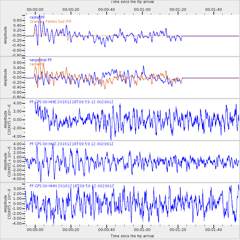
Signal To Noise
| Channel | StoN | STA | LTA |
| PF:GPS:00:HHZ:20161218T09:59:12.002991Z | 2.4001153 | 1.818335E-6 | 7.5760323E-7 |
| PF:GPS:00:HHN:20161218T09:59:12.002991Z | 1.0485259 | 1.4576951E-6 | 1.3902328E-6 |
| PF:GPS:00:HHE:20161218T09:59:12.002991Z | 0.6477446 | 9.4115046E-7 | 1.4529653E-6 |
| Arrivals |
| Ps | |
| PpPs | |
| PsPs/PpSs | |


