You are here: Home > Network List > AV - Alaska Volcano Observatory Stations List
> Station SPCR Ckakachatna River, Mount Spurr, Alaska > Earthquake Result Viewer
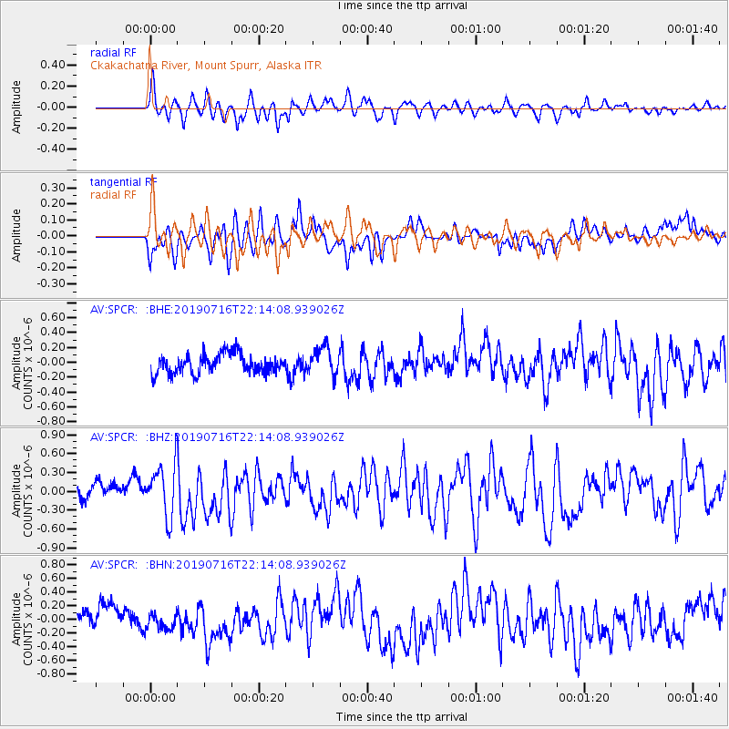
SPCR Ckakachatna River, Mount Spurr, Alaska - Earthquake Result Viewer
*The percent match for this event was below the threshold and hence no stack was calculated.
| Earthquake location: |
South Of Mariana Islands |
| Earthquake latitude/longitude: |
12.3/144.8 |
| Earthquake time(UTC): |
2019/07/16 (197) 22:03:54 GMT |
| Earthquake Depth: |
34 km |
| Earthquake Magnitude: |
5.7 Mi |
| Earthquake Catalog/Contributor: |
NEIC PDE/pt |
|
| Network: |
AV Alaska Volcano Observatory |
| Station: |
SPCR Ckakachatna River, Mount Spurr, Alaska |
| Lat/Lon: |
61.20 N/152.21 W |
| Elevation: |
984 m |
|
| Distance: |
66.4 deg |
| Az: |
28.079 deg |
| Baz: |
251.813 deg |
| Ray Param: |
$rayparam |
*The percent match for this event was below the threshold and hence was not used in the summary stack. |
|
| Radial Match: |
79.09829 % |
| Radial Bump: |
400 |
| Transverse Match: |
59.332184 % |
| Transverse Bump: |
400 |
| SOD ConfigId: |
19053131 |
| Insert Time: |
2019-07-30 22:06:47.362 +0000 |
| GWidth: |
2.5 |
| Max Bumps: |
400 |
| Tol: |
0.001 |
|
Signal To Noise
| Channel | StoN | STA | LTA |
| AV:SPCR: :BHZ:20190716T22:14:08.939026Z | 3.2077768 | 4.3400397E-7 | 1.3529744E-7 |
| AV:SPCR: :BHN:20190716T22:14:08.939026Z | 0.8081312 | 1.4648366E-7 | 1.8126221E-7 |
| AV:SPCR: :BHE:20190716T22:14:08.939026Z | 1.4813963 | 1.9280617E-7 | 1.3015165E-7 |
| Arrivals |
| Ps | |
| PpPs | |
| PsPs/PpSs | |


