V12A Nelson, NV, USA - Earthquake Result Viewer
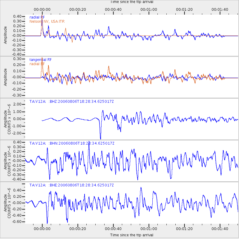
Earthquake location: Bonin Islands, Japan Region
Earthquake latitude/longitude: 26.1/144.0
Earthquake time(UTC): 2006/08/06 (218) 18:16:40 GMT
Earthquake Depth: 23 km
Earthquake Magnitude: 6.0 MB, 5.6 MS, 5.8 MW, 5.8 MW
Earthquake Catalog/Contributor: WHDF/NEIC
Network: TA USArray Transportable Network (new EarthScope stations)
Station: V12A Nelson, NV, USA
Lat/Lon: 35.73 N/114.85 W
Elevation: 1098 m
Distance: 83.5 deg
Az: 53.465 deg
Baz: 297.402 deg
Ray Param: 0.04612006
Estimated Moho Depth: 37.5 km
Estimated Crust Vp/Vs: 1.60
Assumed Crust Vp: 6.276 km/s
Estimated Crust Vs: 3.922 km/s
Estimated Crust Poisson's Ratio: 0.18
Radial Match: 85.13583 %
Radial Bump: 400
Transverse Match: 68.23035 %
Transverse Bump: 400
SOD ConfigId: 2665
Insert Time: 2010-03-07 01:56:49.924 +0000
GWidth: 2.5
Max Bumps: 400
Tol: 0.001

Signal To Noise

ChannelStoNSTALTA
TA:V12A: :BHN:20060806T18:28:34.625017Z1.92405131.5549172E-78.081475E-8
TA:V12A: :BHE:20060806T18:28:34.625017Z3.17800932.387206E-77.511639E-8
TA:V12A: :BHZ:20060806T18:28:34.625017Z6.74406349.3433096E-71.3854124E-7
Arrivals
Ps3.7 SECOND
PpPs15 SECOND
PsPs/PpSs19 SECOND