
V12A Nelson, NV, USA - Earthquake Result Viewer
| ||||||||||||||||||
| ||||||||||||||||||
| ||||||||||||||||||
|
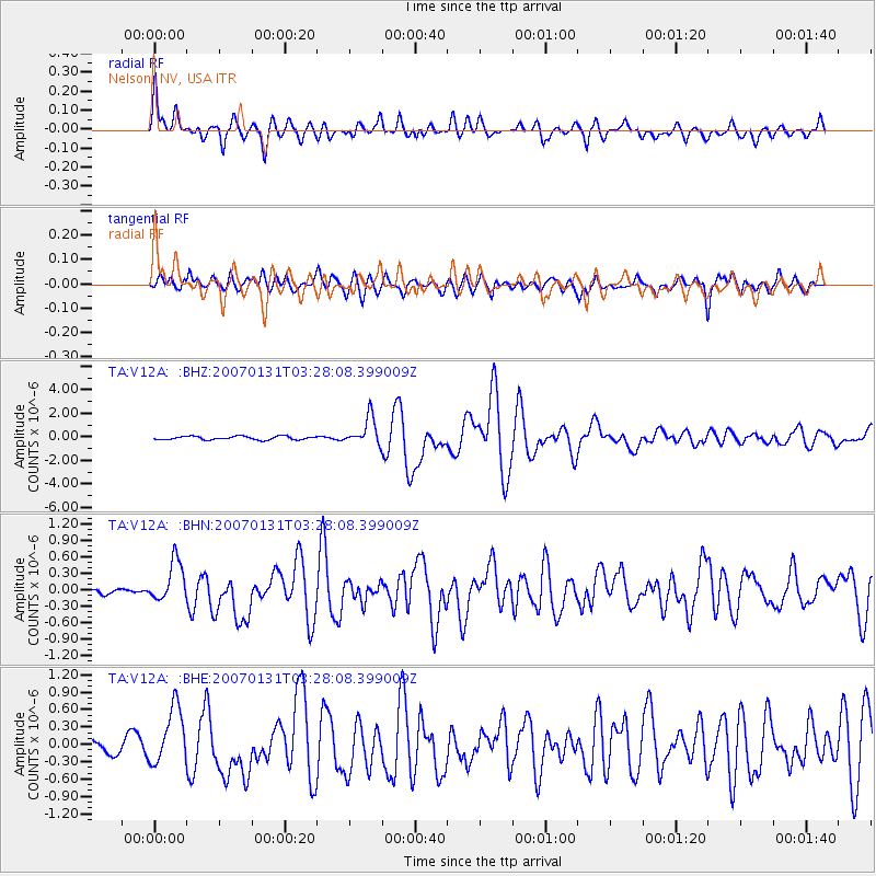
Signal To Noise
| Channel | StoN | STA | LTA |
| TA:V12A: :BHN:20070131T03:28:08.399009Z | 3.4214377 | 3.6476334E-7 | 1.06611125E-7 |
| TA:V12A: :BHE:20070131T03:28:08.399009Z | 3.0991578 | 4.99481E-7 | 1.6116668E-7 |
| TA:V12A: :BHZ:20070131T03:28:08.399009Z | 8.043771 | 1.1762805E-6 | 1.4623497E-7 |
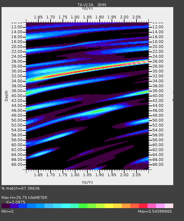
| Arrivals | |
| Ps | 4.6 SECOND |
| PpPs | 12 SECOND |
| PsPs/PpSs | 17 SECOND |

