You are here: Home > Network List > TA - USArray Transportable Network (new EarthScope stations) Stations List
> Station C16K Lisburne Hills, AK, USA > Earthquake Result Viewer
C16K Lisburne Hills, AK, USA - Earthquake Result Viewer
*The percent match for this event was below the threshold and hence no stack was calculated.
| Earthquake location: |
South Of Mariana Islands |
| Earthquake latitude/longitude: |
12.3/144.8 |
| Earthquake time(UTC): |
2019/07/16 (197) 22:03:54 GMT |
| Earthquake Depth: |
34 km |
| Earthquake Magnitude: |
5.7 Mi |
| Earthquake Catalog/Contributor: |
NEIC PDE/pt |
|
| Network: |
TA USArray Transportable Network (new EarthScope stations) |
| Station: |
C16K Lisburne Hills, AK, USA |
| Lat/Lon: |
68.27 N/165.34 W |
| Elevation: |
102 m |
|
| Distance: |
64.5 deg |
| Az: |
18.382 deg |
| Baz: |
235.879 deg |
| Ray Param: |
$rayparam |
*The percent match for this event was below the threshold and hence was not used in the summary stack. |
|
| Radial Match: |
67.22643 % |
| Radial Bump: |
400 |
| Transverse Match: |
61.164646 % |
| Transverse Bump: |
400 |
| SOD ConfigId: |
19053131 |
| Insert Time: |
2019-07-30 22:13:05.241 +0000 |
| GWidth: |
2.5 |
| Max Bumps: |
400 |
| Tol: |
0.001 |
|
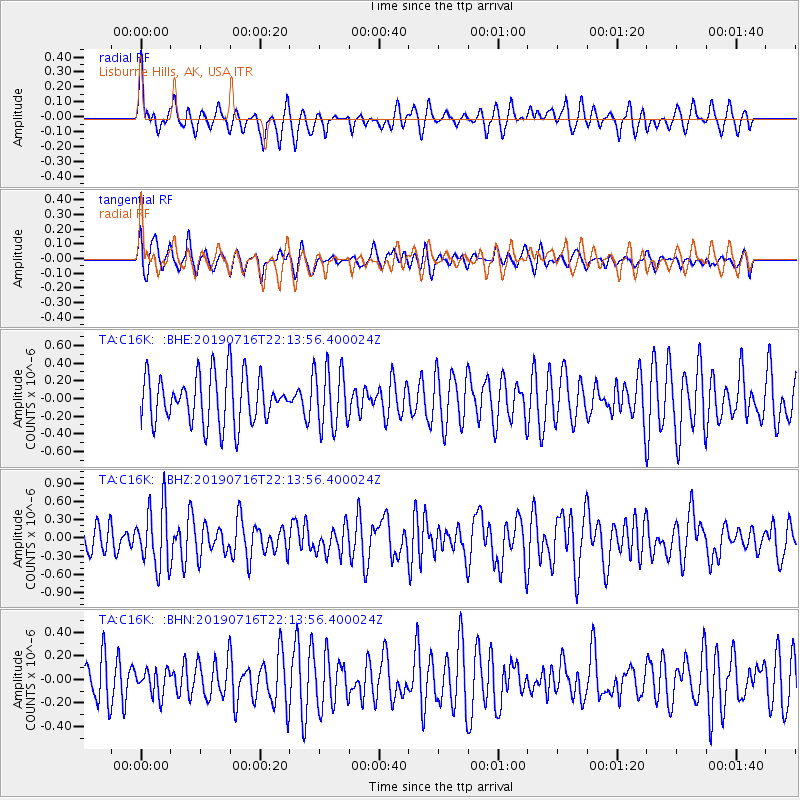
Signal To Noise
| Channel | StoN | STA | LTA |
| TA:C16K: :BHZ:20190716T22:13:56.400024Z | 1.8032249 | 5.05934E-7 | 2.8057175E-7 |
| TA:C16K: :BHN:20190716T22:13:56.400024Z | 0.521709 | 1.0544818E-7 | 2.0212067E-7 |
| TA:C16K: :BHE:20190716T22:13:56.400024Z | 1.2280989 | 3.389583E-7 | 2.7600245E-7 |
| Arrivals |
| Ps | |
| PpPs | |
| PsPs/PpSs | |


