You are here: Home > Network List > TA - USArray Transportable Network (new EarthScope stations) Stations List
> Station I17K Unalakleet, AK, USA > Earthquake Result Viewer
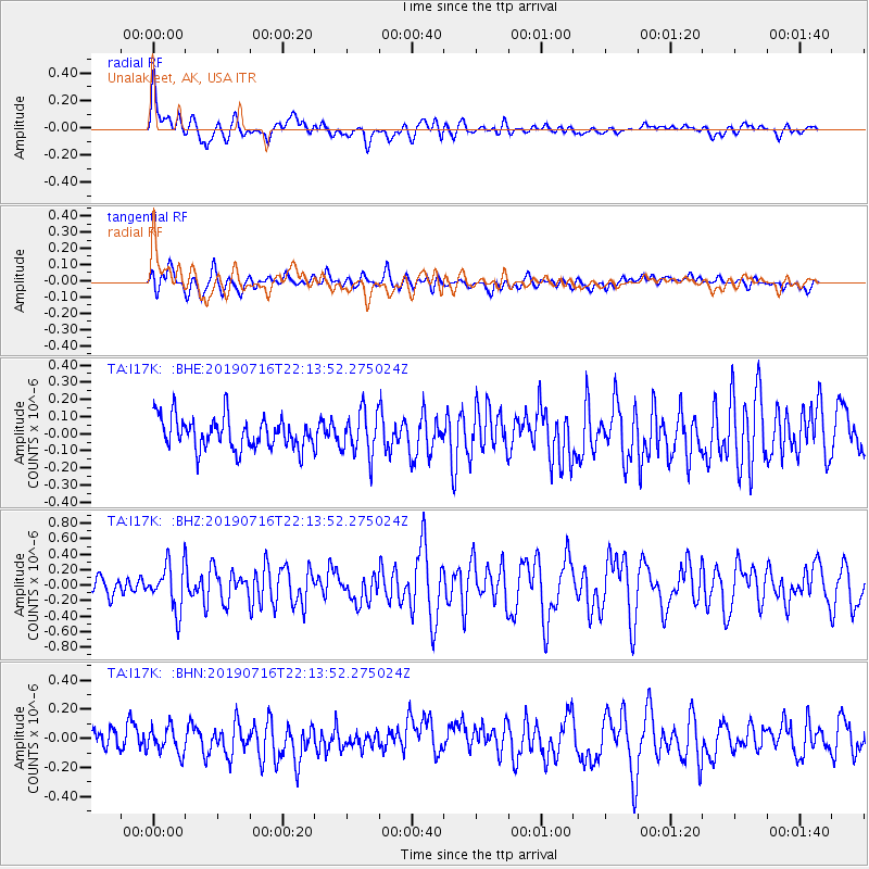
I17K Unalakleet, AK, USA - Earthquake Result Viewer
*The percent match for this event was below the threshold and hence no stack was calculated.
| Earthquake location: |
South Of Mariana Islands |
| Earthquake latitude/longitude: |
12.3/144.8 |
| Earthquake time(UTC): |
2019/07/16 (197) 22:03:54 GMT |
| Earthquake Depth: |
34 km |
| Earthquake Magnitude: |
5.7 Mi |
| Earthquake Catalog/Contributor: |
NEIC PDE/pt |
|
| Network: |
TA USArray Transportable Network (new EarthScope stations) |
| Station: |
I17K Unalakleet, AK, USA |
| Lat/Lon: |
63.89 N/160.70 W |
| Elevation: |
105 m |
|
| Distance: |
63.8 deg |
| Az: |
23.663 deg |
| Baz: |
242.431 deg |
| Ray Param: |
$rayparam |
*The percent match for this event was below the threshold and hence was not used in the summary stack. |
|
| Radial Match: |
73.664604 % |
| Radial Bump: |
400 |
| Transverse Match: |
70.31792 % |
| Transverse Bump: |
400 |
| SOD ConfigId: |
19053131 |
| Insert Time: |
2019-07-30 22:13:58.817 +0000 |
| GWidth: |
2.5 |
| Max Bumps: |
400 |
| Tol: |
0.001 |
|
Signal To Noise
| Channel | StoN | STA | LTA |
| TA:I17K: :BHZ:20190716T22:13:52.275024Z | 3.081765 | 2.9365503E-7 | 9.528794E-8 |
| TA:I17K: :BHN:20190716T22:13:52.275024Z | 1.255555 | 8.814211E-8 | 7.0201715E-8 |
| TA:I17K: :BHE:20190716T22:13:52.275024Z | 1.3948296 | 1.273764E-7 | 9.1320395E-8 |
| Arrivals |
| Ps | |
| PpPs | |
| PsPs/PpSs | |


