I03A Eugene, OR, USA - Earthquake Result Viewer
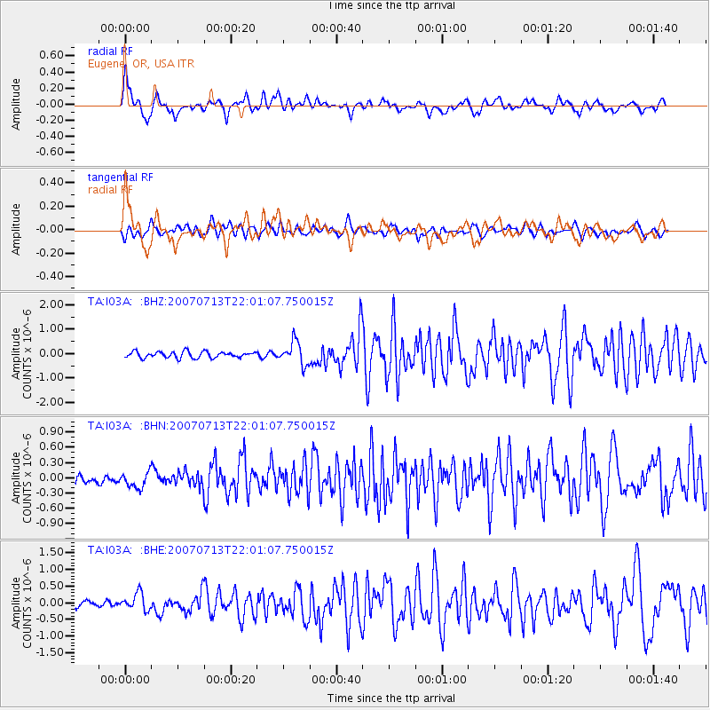
Earthquake location: Andreanof Islands, Aleutian Is.
Earthquake latitude/longitude: 51.8/-176.3
Earthquake time(UTC): 2007/07/13 (194) 21:54:43 GMT
Earthquake Depth: 35 km
Earthquake Magnitude: 5.7 MB, 5.6 MS, 6.0 MW, 5.9 MW
Earthquake Catalog/Contributor: WHDF/NEIC
Network: TA USArray Transportable Network (new EarthScope stations)
Station: I03A Eugene, OR, USA
Lat/Lon: 43.97 N/123.28 W
Elevation: 206 m
Distance: 35.7 deg
Az: 81.27 deg
Baz: 301.854 deg
Ray Param: 0.07702098
Estimated Moho Depth: 44.25 km
Estimated Crust Vp/Vs: 1.85
Assumed Crust Vp: 6.522 km/s
Estimated Crust Vs: 3.52 km/s
Estimated Crust Poisson's Ratio: 0.29
Radial Match: 81.237 %
Radial Bump: 400
Transverse Match: 65.84074 %
Transverse Bump: 400
SOD ConfigId: 2564
Insert Time: 2010-03-07 01:58:36.984 +0000
GWidth: 2.5
Max Bumps: 400
Tol: 0.001

Signal To Noise

ChannelStoNSTALTA
TA:I03A: :BHN:20070713T22:01:07.750015Z1.22341281.7010746E-71.390434E-7
TA:I03A: :BHE:20070713T22:01:07.750015Z2.4132492.6709426E-71.1067828E-7
TA:I03A: :BHZ:20070713T22:01:07.750015Z3.76900554.7375698E-71.2569814E-7
Arrivals
Ps6.2 SECOND
PpPs18 SECOND
PsPs/PpSs24 SECOND