You are here: Home > Network List > G - GEOSCOPE Stations List
> Station UNM Unam,Mexico > Earthquake Result Viewer
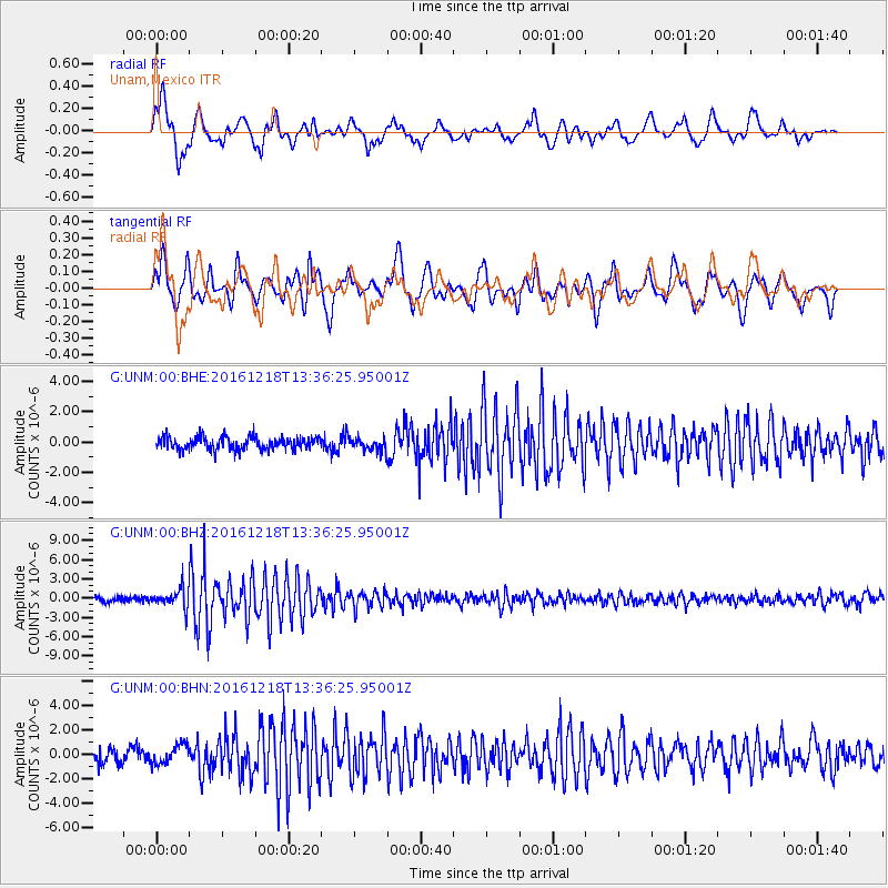
UNM Unam,Mexico - Earthquake Result Viewer
*The percent match for this event was below the threshold and hence no stack was calculated.
| Earthquake location: |
Peru-Brazil Border Region |
| Earthquake latitude/longitude: |
-10.0/-71.0 |
| Earthquake time(UTC): |
2016/12/18 (353) 13:30:11 GMT |
| Earthquake Depth: |
619 km |
| Earthquake Magnitude: |
6.4 Mww |
| Earthquake Catalog/Contributor: |
NEIC PDE/us |
|
| Network: |
G GEOSCOPE |
| Station: |
UNM Unam,Mexico |
| Lat/Lon: |
19.33 N/99.18 W |
| Elevation: |
2280 m |
|
| Distance: |
40.3 deg |
| Az: |
316.306 deg |
| Baz: |
133.893 deg |
| Ray Param: |
$rayparam |
*The percent match for this event was below the threshold and hence was not used in the summary stack. |
|
| Radial Match: |
70.501564 % |
| Radial Bump: |
400 |
| Transverse Match: |
73.0303 % |
| Transverse Bump: |
400 |
| SOD ConfigId: |
1894071 |
| Insert Time: |
2017-01-01 13:31:27.796 +0000 |
| GWidth: |
2.5 |
| Max Bumps: |
400 |
| Tol: |
0.001 |
|
Signal To Noise
| Channel | StoN | STA | LTA |
| G:UNM:00:BHZ:20161218T13:36:25.95001Z | 3.7296119 | 1.5119232E-6 | 4.053835E-7 |
| G:UNM:00:BHN:20161218T13:36:25.95001Z | 1.3710848 | 7.522776E-7 | 5.4867326E-7 |
| G:UNM:00:BHE:20161218T13:36:25.95001Z | 1.029726 | 4.3611868E-7 | 4.235289E-7 |
| Arrivals |
| Ps | |
| PpPs | |
| PsPs/PpSs | |


