C04A Brinnon, WA, USA - Earthquake Result Viewer
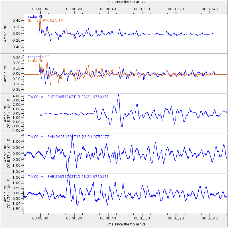
Earthquake location: Near East Coast Of Honshu, Japan
Earthquake latitude/longitude: 38.1/142.1
Earthquake time(UTC): 2005/12/02 (336) 13:13:09 GMT
Earthquake Depth: 29 km
Earthquake Magnitude: 6.1 MB, 6.3 MS, 6.5 MW, 6.4 MW
Earthquake Catalog/Contributor: WHDF/NEIC
Network: TA USArray Transportable Network (new EarthScope stations)
Station: C04A Brinnon, WA, USA
Lat/Lon: 47.72 N/122.97 W
Elevation: 53 m
Distance: 65.9 deg
Az: 47.455 deg
Baz: 300.582 deg
Ray Param: 0.057893034
Estimated Moho Depth: 10.0 km
Estimated Crust Vp/Vs: 2.08
Assumed Crust Vp: 6.566 km/s
Estimated Crust Vs: 3.161 km/s
Estimated Crust Poisson's Ratio: 0.35
Radial Match: 86.33281 %
Radial Bump: 400
Transverse Match: 77.1264 %
Transverse Bump: 400
SOD ConfigId: 2422
Insert Time: 2010-03-07 01:58:52.279 +0000
GWidth: 2.5
Max Bumps: 400
Tol: 0.001

Signal To Noise

ChannelStoNSTALTA
TA:C04A: :BHN:20051202T13:23:21.975017Z1.30489232.2447539E-71.7202599E-7
TA:C04A: :BHE:20051202T13:23:21.975017Z1.75909132.429807E-71.3812853E-7
TA:C04A: :BHZ:20051202T13:23:21.975017Z4.8617767.257259E-71.4927178E-7
Arrivals
Ps1.7 SECOND
PpPs4.5 SECOND
PsPs/PpSs6.2 SECOND